Moyuta (Guatemala)
Status Normal Eruption Unknown 1662m
Stratovolcano (Subduction zone / Continental crust (> 25 km))
Moyuta is the easternmost of a chain of large stratovolcanoes extending along the volcanic front of Guatemala. Like Tecuamburro volcano, it is offset about 20 km S of the main volcanic chain and lies south of the Jalpatagua Fault, overlying the southern boundary of the Jalpatagua Graben. The volcano is capped by a cluster of at least three forested, steep-sided, coalescing andesitic lava domes that from some distant perspectives give the summit a flat-topped appearance. Numerous cinder cones in various stages of erosion are located on the flanks of the complex. The age of the latest eruption is not known, although the summit domes were considered to have been emplaced in relatively recent times (Williams et al., 1964). Small fumaroles are found on the N and S flanks, and hot springs are located near Azulco at the NE base and along rivers on the SE side.
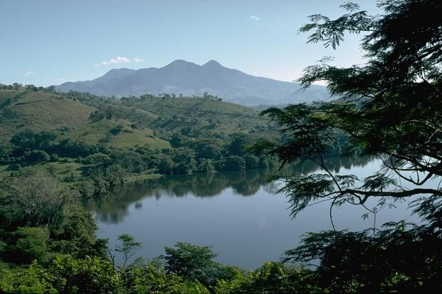
Moyuta is the easternmost of a chain of large stratovolcanoes extending along the volcanic front of Guatemala. The summit of the 1662-m-high volcano contains a cluster of forested lava domes. It is viewed here from a small lake to its SW at the edge of the Pacific coastal plain. The age of the latest eruption of Moyuta volcano is not known.
Photo by Lee Siebert, 1988 (Smithsonian Institution).
Last updated 2019-08-04 00:28:03

Camera
Latest activity
Aww Error :(
Data not available
