Guayaques (Chile-Bolivia)
Status Normal Eruption Unknown 5598m
Lava dome(s) (Subduction zone / Continental crust (> 25 km))
The Cerros de Guayaques group of N-S-trending rhyodacitic lava domes straddles the Chile-Bolivia border. The 10-km-long chain is located immediately E of the Purico pyroclastic shield. There is some evidence for Holocene activity, and the youngest domes appear to be N of the summit crater of the dome complex (de Silva and Francis, 1991). A well-defined summit crater was the source of the largest lava flows, which traveled 3 km to the SW. There are no records of historical activity.
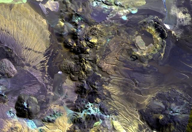
The irregular 10-km-long N-S-trending chain just left of the center of this Landsat image is Cerros de Guayaques. These rhyodacitic lava domes straddle the Chile-Bolivia border. The 10-km-long chain is located immediately east of the Purico pyroclastic shield, part of which is visible on the left side of the image. A well-defined summit crater was the source of the largest lava flows, which form the lobate flows that extend 3 km to the SW. There are no records of historical activity from Guayaques volcano.
NASA Landsat image, 1999 (courtesy of Hawaii Synergy Project, Univ. of Hawaii Institute of Geophysics & Planetology).
Last updated 2019-08-04 00:28:03

Camera
Latest activity
Aww Error :(
Data not available
