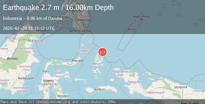
Earthquake Halmahera, Indonesia
Fri, 20 Feb 2026 18:15:12 GMT
Time1 hour ago
Location
2.4463, 128.6711
Depth
16.0 KM
Event Summary
A 2.7 magnitude earthquake struck on Halmahera, Indonesia, at Fri, 20 Feb 2026 18:15:12 GMT. Depth: 15.964599km. Reviewed by BMKG seismologists, this minor quake occurred at a magnitude type of M.
Magnitude
2.7
M
Source
BMKG
Intensity
-
Agency Reports
1 Sources| Source | Magnitude | Depth | Time |
|---|---|---|---|
| BMKGPrimary | 2.7 | 16 km | 1 hour ago |
Earthquake Details
ManualEvent IDbmg2026doth
Tsunami PotentialNo
Magnitude TypeM
Nearest Places
- Misio1.9 km
- Desa Gorua2.3 km
- Tanjung Misio2.7 km
- Gurua3.1 km
- Desa Gorua Selatan3.4 km
Comments
Join the discussion about this event.
Latest Earthquakes
1.4Mag
14 km NNW of Stanton, Texas
Time1 hour ago
Depth3.64 km
SourceUSGS (Automatic)
2.6Mag
Java, Indonesia
Time1 hour ago
Depth12.69 km
SourceBMKG
2.2Mag
Southern Sumatra, Indonesia
Time1 hour ago
Depth24.35 km
SourceBMKG
1.9Mag
60 km S of Whites City, New Mexico
Time1 hour ago
Depth5.71 km
SourceUSGS (Automatic)
1.7Mag
Southern Alaska
Time1 hour ago
Depth91.31 km
SourceVYT (Automatic)
Nearby Earthquakes
4.0Mag
HALMAHERA, INDONESIA
Time2 years ago
Depth256.00 km
SourceBMKG (Automatic)
5.4Mag
HALMAHERA, INDONESIA
Time17 years ago
Depth69.00 km
SourceEMSC (Automatic)
5.0Mag
HALMAHERA, INDONESIA
Time8 years ago
Depth10.00 km
SourceEMSC (Automatic)
5.5Mag
HALMAHERA, INDONESIA
Time8 years ago
Depth53.00 km
SourceEMSC (Automatic)
2.8Mag
Halmahera, Indonesia
Time19 hours ago
Depth8.18 km
SourceBMKG