Earthquake South of Bali, Indonesia
Wed, 20 May 2026 16:28:20 GMT
Time4 days ago
Location
-9.3891, 115.1751
Depth
19.0 KM
Event Summary
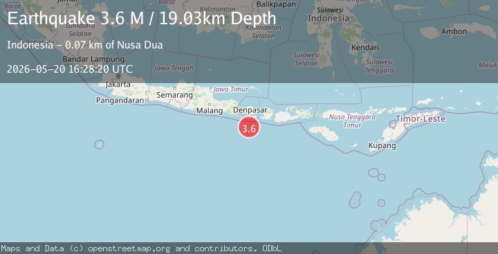
A 3.6 magnitude earthquake struck on South of Bali, Indonesia, at Wed, 20 May 2026 16:28:20 GMT. Depth: 19.028366km. Reviewed by BMKG seismologists, this minor quake occurred at a magnitude type of M.
Magnitude
3.6
M
Source
BMKG
Intensity
I
Agency Reports
1 Sources| Source | Magnitude | Depth | Time |
|---|---|---|---|
| BMKGPrimary | 3.6 | 19 km | 4 days ago |
Earthquake Details
ManualEvent IDbmg2026jvfn
QualityS
Tsunami PotentialNo
Magnitude TypeM
Last Update4 days ago
Nearest Places
Possibly felt by: 64.9K
- 65.8 km2.5K people
- 66.5 km1.8K people
- 73.5 km
- IKuta74.0 km30K people
- 76.2 km10K people
- 76.4 km
- 80.0 km14.6K people
- 82.3 km725.3K people
- 83.0 km
- 90.0 km
- 94.0 km
- 94.4 km33.7K people
- 95.5 km
- 97.3 km
Felt Reports0
Did you feel this earthquake? Report it to help others.
No reports yet
Be the first to report this earthquake!
Latest Earthquakes
Loading...
Nearby Earthquakes
2.7Mag
South of Bali, Indonesia
Time7 hours ago
Depth10.00 km
SourceBMKG
2.0Mag
Bali Region, Indonesia
Time1 day ago
Depth57.54 km
SourceBMKG
2.3Mag
South of Bali, Indonesia
Time3 days ago
Depth10.00 km
SourceBMKG
2.4Mag
Sumbawa Region, Indonesia
Time4 days ago
Depth10.00 km
SourceBMKG
2.4Mag
Sumbawa Region, Indonesia
Time4 days ago
Depth10.00 km
SourceBMKG