Earthquake NEAR N COAST OF PAPUA, INDONESIA
Sun, 04 Jan 2026 13:58:17 GMT
Time1 month ago
Location
-0.2600, 132.1500
Depth
10.0 KM
Event Summary
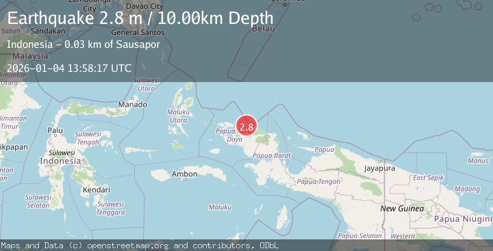
A 2.8 magnitude earthquake struck on NEAR N COAST OF PAPUA, INDONESIA, at Sun, 04 Jan 2026 13:58:17 GMT. Depth: 10km. Reviewed by BMKG seismologists, this minor quake occurred at a magnitude type of m.
Magnitude
2.8
m
Source
BMKG
Intensity
-
Agency Reports
1 Sources| Source | Magnitude | Depth | Time |
|---|---|---|---|
| BMKGPrimary | 2.8 | 10 km | 1 month ago |
Earthquake Details
AutomaticEvent IDemsc_BMKG_20260104_0000186
Tsunami PotentialNo
Magnitude Typem
Nearest Places
- Pulau Amsterdam9.9 km
- Mios Su11.6 km
- Pulau Middelburg13.2 km
- Mar17.8 km
- Pantai Werur17.8 km
Comments
Join the discussion about this event.
Latest Earthquakes
2.4Mag
Fox Islands, Aleutian Islands, Alaska
Time5 minutes ago
Depth14.04 km
SourceVYT (Automatic)
1.9Mag
Southern Alaska
Time7 minutes ago
Depth94.24 km
SourceVYT (Automatic)
2.5Mag
Antofagasta, Chile
Time10 minutes ago
Depth0.00 km
SourceVYT (Automatic)
3.3Mag
Banda Sea
Time11 minutes ago
Depth189.73 km
SourceBMKG
0.9Mag
15 km ESE of Little Lake, CA
Time16 minutes ago
Depth7.57 km
SourceUSGS (Automatic)
Nearby Earthquakes
3.0Mag
NEAR N COAST OF PAPUA, INDONESIA
Time1 year ago
Depth10.00 km
SourceBMKG (Automatic)
2.0Mag
West Papua Region, Indonesia
Time1 week ago
Depth15.44 km
SourceBMKG
2.6Mag
NEAR N COAST OF PAPUA, INDONESIA
Time1 month ago
Depth10.00 km
SourceBMKG (Automatic)
4.0Mag
NEAR N COAST OF PAPUA, INDONESIA
Time5 years ago
Depth10.00 km
SourceNEIC (Automatic)
4.0Mag
NEAR N COAST OF PAPUA, INDONESIA
Time5 years ago
Depth10.00 km
SourceDJA (Automatic)