Earthquake SOUTH OF KERMADEC ISLANDS
Thu, 13 Feb 2014 01:41:05 GMT
Time12 years ago
Location
-32.8700, -178.7200
Depth
30.0 KM
Event Summary
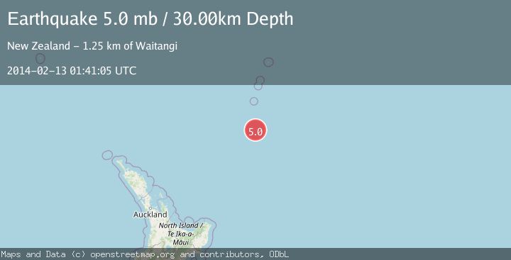
A 5.0 magnitude earthquake struck on SOUTH OF KERMADEC ISLANDS, at Thu, 13 Feb 2014 01:41:05 GMT. Depth: 30km. Reviewed by EMSC seismologists, this moderate quake occurred at a magnitude type of mb.
Magnitude
5.0
mb
Source
EMSC
Intensity
-
Agency Reports
1 Sources| Source | Magnitude | Depth | Time |
|---|---|---|---|
| EMSCPrimary | 5.0 | 30 km | 12 years ago |
Earthquake Details
AutomaticEvent IDemsc_EMSC_20140213_0000009
Tsunami PotentialNo
Magnitude Typemb
Nearest Places
- Star of Bengal Bank61.7 km
- Haungaroa Seamount89.9 km
- Speight Knoll97.5 km
- Oliver Knoll103.7 km
- Kuiwai Seamount116.6 km
Comments
Join the discussion about this event.
Latest Earthquakes
1.5Mag
Tarapaca, Chile
Time5 minutes ago
Depth12.94 km
SourceVYT (Automatic)
2.0Mag
Poland
Time6 minutes ago
Depth6.35 km
SourceVYT (Automatic)
3.7Mag
north of Halmahera, Indonesia
Time7 minutes ago
Depth1.22 km
SourceVYT (Automatic)
3.1Mag
Halmahera, Indonesia
Time10 minutes ago
Depth22.95 km
SourceVYT (Automatic)
2.4Mag
Fox Islands, Aleutian Islands, Alaska
Time22 minutes ago
Depth14.04 km
SourceVYT (Automatic)
Nearby Earthquakes
5.0Mag
SOUTH OF KERMADEC ISLANDS
Time14 years ago
Depth104.00 km
SourceEMSC (Automatic)
5.1Mag
SOUTH OF KERMADEC ISLANDS
Time2 years ago
Depth41.00 km
SourceNEIC (Automatic)
4.0Mag
SOUTH OF KERMADEC ISLANDS
Time2 years ago
Depth35.00 km
SourceNEIC (Automatic)
5.0Mag
SOUTH OF KERMADEC ISLANDS
Time20 years ago
Depth10.00 km
SourceNEIC (Automatic)
5.1Mag
SOUTH OF KERMADEC ISLANDS
Time6 years ago
Depth30.00 km
SourceEMSC (Automatic)