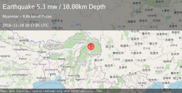
Earthquake MYANMAR-INDIA BORDER REGION
Wed, 28 Nov 2018 10:17:05 GMT
Time7 years ago
Location
27.1800, 97.0300
Depth
10.0 KM
Event Summary
A 5.3 magnitude earthquake struck on MYANMAR-INDIA BORDER REGION, at Wed, 28 Nov 2018 10:17:05 GMT. Depth: 10km. Reviewed by EMSC seismologists, this moderate quake occurred at a magnitude type of mw.
Magnitude
5.3
mw
Source
EMSC
Intensity
-
Agency Reports
1 Sources| Source | Magnitude | Depth | Time |
|---|---|---|---|
| EMSCPrimary | 5.3 | 10 km | 7 years ago |
Earthquake Details
AutomaticEvent IDemsc_EMSC_20181128_0000033
Tsunami PotentialNo
Magnitude Typemw
Nearest Places
- 3.8 km
- 10.2 km
- 10.3 km
- 12.3 km
- 12.5 km
Comments
Join the discussion about this event.
Latest Earthquakes
3.1Mag
Tarapaca, Chile
Time38 seconds ago
Depth95.46 km
SourceVYT (Automatic)
2.0Mag
Washington
Time2 minutes ago
Depth20.39 km
SourceVYT (Automatic)
2.4Mag
ISLAND OF HAWAII, HAWAII
Time5 minutes ago
Depth33.70 km
SourceHV (Automatic)
3.5Mag
SIKKIM, INDIA
Time12 minutes ago
Depth6.70 km
SourceNDI (Automatic)
2.5Mag
South of Java, Indonesia
Time17 minutes ago
Depth162.67 km
SourceBMKG
Nearby Earthquakes
5.2Mag
MYANMAR-INDIA BORDER REGION
Time7 years ago
Depth40.00 km
SourceEMSC (Automatic)
5.1Mag
102 km SSE of Hayuliang, India
Time1 month ago
Depth10.00 km
SourceUSGS
5.0Mag
MYANMAR
Time2 years ago
Depth10.00 km
SourceEMSC (Automatic)
5.2Mag
MYANMAR-INDIA BORDER REGION
Time7 years ago
Depth40.00 km
SourceEMSC (Automatic)
5.8Mag
MYANMAR
Time1 year ago
Depth14.50 km
SourceEMSC (Automatic)