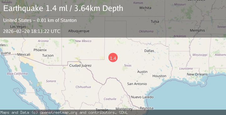
Earthquake 14 km NNW of Stanton, Texas
Fri, 20 Feb 2026 18:13:22 GMT
Time1 hour ago
Location
32.2510, -101.8540
Depth
3.6 KM
Event Summary
A 1.4 magnitude earthquake struck on 14 km NNW of Stanton, Texas, at Fri, 20 Feb 2026 18:13:22 GMT. Depth: 3.6431km. Reviewed by USGS seismologists, this minor quake occurred at a magnitude type of ml.
Magnitude
1.4
ml
Source
USGS
Intensity
-
Agency Reports
1 Sources| Source | Magnitude | Depth | Time |
|---|---|---|---|
| USGSPrimary | 1.4 | 4 km | 1 hour ago |
Earthquake Details
AutomaticEvent IDusgs_tx2026dpeofm
Tsunami PotentialNo
Magnitude Typeml
Nearest Places
- Permian Basin Encampment4.0 km
- Lenorah Post Office6.2 km
- Lenorah6.3 km
- Lenorah Volunteer Fire Department6.6 km
- Windmill on the Hill7.0 km
Comments
Join the discussion about this event.
Latest Earthquakes
2.7Mag
Halmahera, Indonesia
Time1 hour ago
Depth15.96 km
SourceBMKG
2.6Mag
Java, Indonesia
Time1 hour ago
Depth12.69 km
SourceBMKG
2.2Mag
Southern Sumatra, Indonesia
Time1 hour ago
Depth24.35 km
SourceBMKG
1.9Mag
60 km S of Whites City, New Mexico
Time1 hour ago
Depth5.71 km
SourceUSGS (Automatic)
1.7Mag
Southern Alaska
Time1 hour ago
Depth91.31 km
SourceVYT (Automatic)
Nearby Earthquakes
1.8Mag
16 km NNW of Stanton, Texas
Time1 week ago
Depth4.59 km
SourceUSGS (Automatic)
1.1Mag
16 km NW of Stanton, Texas
Time4 days ago
Depth4.14 km
SourceUSGS (Automatic)
1.1Mag
16 km NW of Stanton, Texas
Time4 days ago
Depth4.18 km
SourceUSGS (Automatic)
2.2Mag
WESTERN TEXAS
Time1 month ago
Depth8.70 km
SourceTX (Automatic)
2.2Mag
WESTERN TEXAS
Time1 month ago
Depth8.70 km
SourceTX (Automatic)