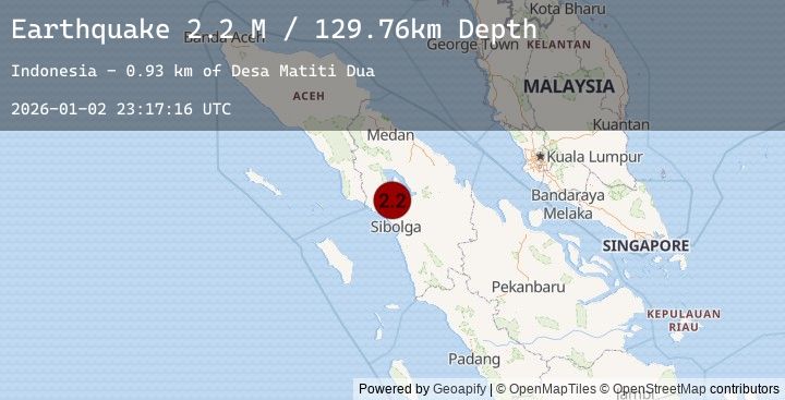
Earthquake Northern Sumatra, Indonesia
Fri, 02 Jan 2026 23:17:16 GMT
Time4 hours ago
Location
2.2706, 98.7144
Depth
129.8 KM
Event Summary
A 2.2 magnitude earthquake struck on Northern Sumatra, Indonesia, at Fri, 02 Jan 2026 23:17:16 GMT. Depth: 129.756561km. Reviewed by BMKG seismologists, this minor quake occurred at a magnitude type of M.
Magnitude
2.2
M
Source
BMKG
Intensity
-
Agency Reports
1 Sources| Source | Magnitude | Depth | Time |
|---|---|---|---|
| BMKGPrimary | 2.2 | 130 km | 4 hours ago |
Earthquake Details
AutomaticEvent IDbmg2026adpp
Tsunami PotentialNo
Magnitude TypeM
Nearest Places
- Desa Matiti Dua0.9 km
- Desa Silaga Laga1.2 km
- Desa Matiti2.4 km
- Desa Sihite Satu2.8 km
- Pasartambok Satu2.8 km
Comments
Join the discussion about this event.
Latest Earthquakes
3.5Mag
NEAR THE COAST OF WESTERN TURKEY
Time4 hours ago
Depth10.00 km
SourceTHE (Automatic)
2.1Mag
34 km WNW of Nikiski, Alaska
Time4 hours ago
Depth82.10 km
SourceUSGS (Automatic)
2.4Mag
Bali Sea
Time4 hours ago
Depth11.04 km
SourceBMKG (Automatic)
2.9Mag
OFFSHORE MAULE, CHILE
Time4 hours ago
Depth23.20 km
SourceCSN (Automatic)
3.5Mag
EASTERN TURKEY
Time4 hours ago
Depth4.40 km
SourceKOERI (Automatic)