Earthquake Southern Sumatra, Indonesia
Mon, 05 Jan 2026 04:01:47 GMT
Time2 days ago
Location
-0.2705, 98.9068
Depth
53.2 KM
Event Summary
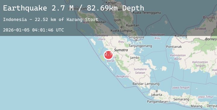
A 2.8 magnitude earthquake struck on Southern Sumatra, Indonesia, at Mon, 05 Jan 2026 04:01:47 GMT. Depth: 53.199539km. Reviewed by BMKG seismologists, this minor quake occurred at a magnitude type of M.
Magnitude
2.8
M
Source
BMKG
Intensity
-
Agency Reports
1 Sources| Source | Magnitude | Depth | Time |
|---|---|---|---|
| BMKGPrimary | 2.8 | 53 km | 2 days ago |
Earthquake Details
AutomaticEvent IDbmg2026ahpz
Tsunami PotentialNo
Magnitude TypeM
Nearest Places
- Karang Anso30.6 km
- Pulau Anso33.6 km
- Pulau Sambulaling35.1 km
- Karang Sambulaling36.9 km
- Tanjung Anjing38.1 km
Comments
Join the discussion about this event.
Latest Earthquakes
2.1Mag
CENTRAL ITALY
Time2 days ago
Depth21.00 km
SourceINGV (Automatic)
3.6Mag
South of Java, Indonesia
Time2 days ago
Depth10.00 km
SourceBMKG (Automatic)
1.0Mag
6 km S of Redlands, CA
Time2 days ago
Depth14.14 km
SourceUSGS (Automatic)
3.4Mag
NEAR EAST COAST OF HONSHU, JAPAN
Time2 days ago
Depth50.00 km
SourceJMA (Automatic)
2.8Mag
Sumbawa Region, Indonesia
Time2 days ago
Depth28.53 km
SourceBMKG (Automatic)
Nearby Earthquakes
No significant earthquakes nearby recently.