Earthquake Southern Sumatra, Indonesia
Mon, 05 Jan 2026 09:10:41 GMT
Time2 days ago
Location
-4.6523, 102.5437
Depth
10.0 KM
Event Summary
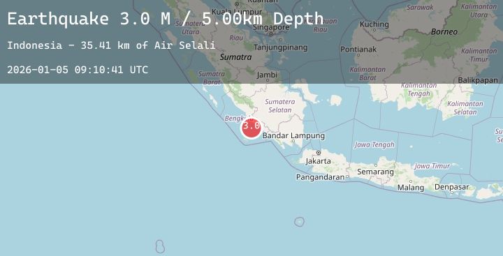
A 2.9 magnitude earthquake struck on Southern Sumatra, Indonesia, at Mon, 05 Jan 2026 09:10:41 GMT. Depth: 10km. Reviewed by BMKG seismologists, this minor quake occurred at a magnitude type of M.
Magnitude
2.9
M
Source
BMKG
Intensity
-
Agency Reports
1 Sources| Source | Magnitude | Depth | Time |
|---|---|---|---|
| BMKGPrimary | 2.9 | 10 km | 2 days ago |
Earthquake Details
AutomaticEvent IDbmg2026aiae
Tsunami PotentialNo
Magnitude TypeM
Nearest Places
- Air Selali42.7 km
- Selali42.8 km
- Air Alas43.2 km
- Air Maras43.3 km
- Pasaralas43.4 km
Comments
Join the discussion about this event.
Latest Earthquakes
2.7Mag
Java, Indonesia
Time2 days ago
Depth202.25 km
SourceBMKG (Automatic)
3.9Mag
JAVA SEA
Time2 days ago
Depth538.00 km
SourceBMKG (Automatic)
1.3Mag
113 km NW of Yakutat, Alaska
Time2 days ago
Depth10.70 km
SourceUSGS (Automatic)
2.6Mag
CENTRAL ITALY
Time2 days ago
Depth21.80 km
SourceINGV (Automatic)
2.1Mag
Bali Region, Indonesia
Time2 days ago
Depth10.00 km
SourceBMKG (Automatic)
Nearby Earthquakes
No significant earthquakes nearby recently.