Earthquake Northern Sumatra, Indonesia
Mon, 05 Jan 2026 10:20:36 GMT
Time2 days ago
Location
4.2107, 97.4513
Depth
0.0 KM
Event Summary
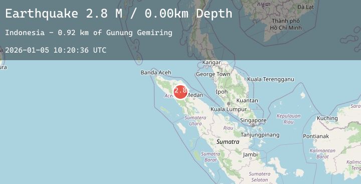
A 2.4 magnitude earthquake struck on Northern Sumatra, Indonesia, at Mon, 05 Jan 2026 10:20:36 GMT. Depth: 0km. Reviewed by BMKG seismologists, this minor quake occurred at a magnitude type of M.
Magnitude
2.4
M
Source
BMKG
Intensity
-
Agency Reports
1 Sources| Source | Magnitude | Depth | Time |
|---|---|---|---|
| BMKGPrimary | 2.4 | 0 km | 2 days ago |
Earthquake Details
AutomaticEvent IDbmg2026aicn
Tsunami PotentialNo
Magnitude TypeM
Nearest Places
- Gunung Gemiring0.9 km
- Gunung Lembu2.2 km
- Gunung Anu3.2 km
- Gunung Lojang3.5 km
- Arul Pepelah4.1 km
Comments
Join the discussion about this event.
Latest Earthquakes
3.8Mag
Talaud Islands, Indonesia
Time2 days ago
Depth10.00 km
SourceBMKG (Automatic)
1.9Mag
112 km NW of Yakutat, Alaska
Time2 days ago
Depth0.90 km
SourceUSGS (Automatic)
1.7Mag
21 km SSE of Pāhala, Hawaii
Time2 days ago
Depth34.88 km
SourceUSGS (Automatic)
1.9Mag
CENTRAL TURKEY
Time2 days ago
Depth7.00 km
SourceAFAD (Automatic)
3.3Mag
WESTERN HONSHU, JAPAN
Time2 days ago
Depth10.00 km
SourceJMA (Automatic)
Nearby Earthquakes
No significant earthquakes nearby recently.