Earthquake Sumba Region, Indonesia
Mon, 05 Jan 2026 12:57:32 GMT
Time4 days ago
Location
-9.3141, 120.1984
Depth
11.7 KM
Event Summary
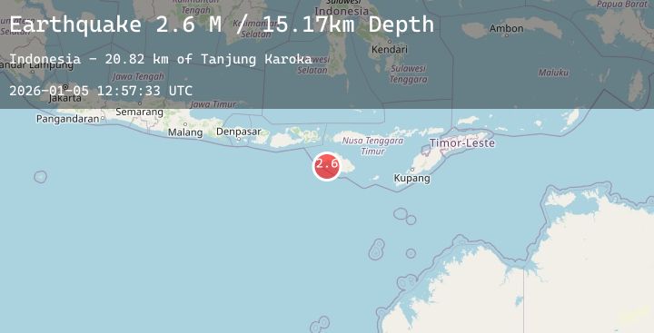
A 2.2 magnitude earthquake struck on Sumba Region, Indonesia, at Mon, 05 Jan 2026 12:57:32 GMT. Depth: 11.653498km. Reviewed by BMKG seismologists, this minor quake occurred at a magnitude type of M.
Magnitude
2.2
M
Source
BMKG
Intensity
-
Agency Reports
1 Sources| Source | Magnitude | Depth | Time |
|---|---|---|---|
| BMKGPrimary | 2.2 | 12 km | 4 days ago |
Earthquake Details
AutomaticEvent IDbmg2026aihr
Tsunami PotentialNo
Magnitude TypeM
Nearest Places
- Tanjung Laundi17.5 km
- Tanjung Ngaruruhu17.9 km
- Tanjung Pambutuwitjukarambua20.3 km
- Paluhu20.5 km
- Luku Laramahi20.5 km
Comments
Join the discussion about this event.
Latest Earthquakes
1.7Mag
13 km SW of Searles Valley, CA
Time4 days ago
Depth7.28 km
SourceUSGS (Automatic)
2.8Mag
Sulawesi, Indonesia
Time4 days ago
Depth10.95 km
SourceBMKG (Automatic)
1.9Mag
7 km S of Muir Beach, CA
Time4 days ago
Depth6.44 km
SourceUSGS (Automatic)
3.5Mag
LUZON, PHILIPPINES
Time4 days ago
Depth10.00 km
SourcePIVS (Automatic)
1.0Mag
WESTERN TURKEY
Time4 days ago
Depth7.00 km
SourceAFAD (Automatic)