Earthquake Timor Region
Tue, 06 Jan 2026 18:47:22 GMT
Time3 days ago
Location
-8.0438, 124.6317
Depth
19.3 KM
Event Summary
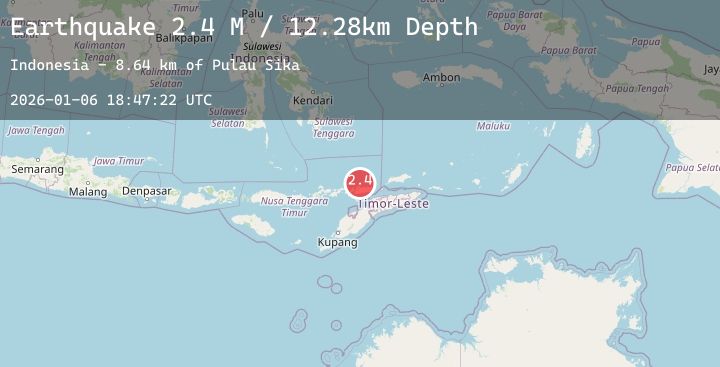
A 2.3 magnitude earthquake struck on Timor Region, at Tue, 06 Jan 2026 18:47:22 GMT. Depth: 19.259577km. Reviewed by BMKG seismologists, this minor quake occurred at a magnitude type of M.
Magnitude
2.3
M
Source
BMKG
Intensity
-
Agency Reports
1 Sources| Source | Magnitude | Depth | Time |
|---|---|---|---|
| BMKGPrimary | 2.3 | 19 km | 3 days ago |
Earthquake Details
AutomaticEvent IDbmg2026akos
Tsunami PotentialNo
Magnitude TypeM
Nearest Places
- Pulau Sika8.6 km
- Tanjung Sika9.7 km
- Alor Island Airport10.6 km
- Leiling10.8 km
- Pantai Deere10.9 km
Comments
Join the discussion about this event.
Latest Earthquakes
1.2Mag
34 km E of McKinney Acres, Texas
Time3 days ago
Depth5.22 km
SourceUSGS (Automatic)
2.1Mag
Java, Indonesia
Time3 days ago
Depth26.82 km
SourceBMKG (Automatic)
1.9Mag
8 km SSW of Pāhala, Hawaii
Time3 days ago
Depth32.65 km
SourceUSGS (Automatic)
2.0Mag
21 km NNE of Hala‘ula, Hawaii
Time3 days ago
Depth13.39 km
SourceUSGS (Automatic)
2.3Mag
Java, Indonesia
Time3 days ago
Depth85.51 km
SourceBMKG (Automatic)