Earthquake Sumba Region, Indonesia
Fri, 09 Jan 2026 07:54:45 GMT
Time2 days ago
Location
-9.6895, 120.8769
Depth
64.6 KM
Event Summary
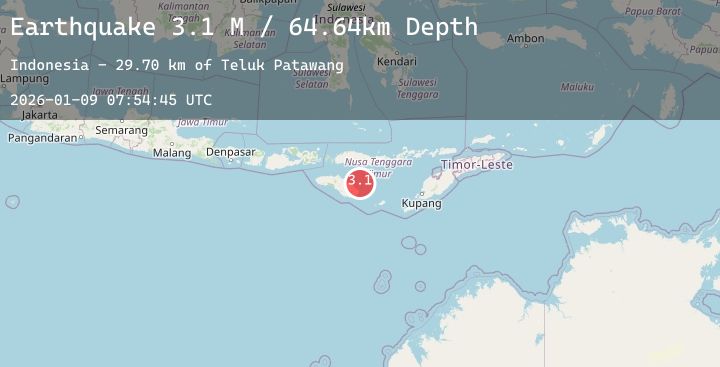
A 3.1 magnitude earthquake struck on Sumba Region, Indonesia, at Fri, 09 Jan 2026 07:54:45 GMT. Depth: 64.64167km. Reviewed by BMKG seismologists, this minor quake occurred at a magnitude type of M.
Magnitude
3.1
M
Source
BMKG
Intensity
-
Agency Reports
1 Sources| Source | Magnitude | Depth | Time |
|---|---|---|---|
| BMKGPrimary | 3.1 | 65 km | 2 days ago |
Earthquake Details
AutomaticEvent IDbmg2026apfr
Tsunami PotentialNo
Magnitude TypeM
Nearest Places
- Teluk Patawang29.7 km
- Tanjung Patawang29.8 km
- Tanjung Warajangga29.9 km
- Muripado30.0 km
- Titunoho30.1 km
Comments
Join the discussion about this event.
Latest Earthquakes
1.2Mag
5 km NW of The Geysers, CA
Time2 days ago
Depth2.97 km
SourceUSGS (Automatic)
2.0Mag
Bali Region, Indonesia
Time2 days ago
Depth10.00 km
SourceBMKG (Automatic)
2.9Mag
ALASKA PENINSULA
Time2 days ago
Depth73.90 km
SourceAK (Automatic)
2.2Mag
Sumbawa Region, Indonesia
Time2 days ago
Depth23.74 km
SourceBMKG (Automatic)
3.1Mag
Minahassa Peninsula, Sulawesi
Time2 days ago
Depth10.00 km
SourceBMKG (Automatic)
Nearby Earthquakes
No significant earthquakes nearby recently.