Earthquake Sumbawa Region, Indonesia
Sun, 11 Jan 2026 12:06:49 GMT
Time20 hours ago
Location
-8.2903, 117.7563
Depth
24.1 KM
Event Summary
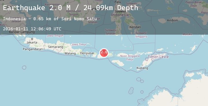
A 2.0 magnitude earthquake struck on Sumbawa Region, Indonesia, at Sun, 11 Jan 2026 12:06:49 GMT. Depth: 24.087589km. Reviewed by BMKG seismologists, this minor quake occurred at a magnitude type of M.
Magnitude
2.0
M
Source
BMKG
Intensity
-
Agency Reports
1 Sources| Source | Magnitude | Depth | Time |
|---|---|---|---|
| BMKGPrimary | 2.0 | 24 km | 20 hours ago |
Earthquake Details
AutomaticEvent IDbmg2026atfa
Tsunami PotentialNo
Magnitude TypeM
Nearest Places
- Sori Nomo Satu0.7 km
- Oiua1.2 km
- Punia1.4 km
- Sori Peto1.6 km
- Karangmete1.7 km
Comments
Join the discussion about this event.
Latest Earthquakes
2.7Mag
AZORES-CAPE ST. VINCENT RIDGE
Time20 hours ago
Depth42.00 km
SourceIPMA (Automatic)
2.6Mag
Minahassa Peninsula, Sulawesi
Time20 hours ago
Depth5.00 km
SourceBMKG (Automatic)
2.5Mag
Minahassa Peninsula, Sulawesi
Time21 hours ago
Depth105.22 km
SourceBMKG (Automatic)
3.7Mag
NEAR COAST OF NORTHERN PERU
Time21 hours ago
Depth51.00 km
SourceLIM (Automatic)
2.1Mag
3 km SW of Pāhala, Hawaii
Time21 hours ago
Depth30.33 km
SourceUSGS (Automatic)
Nearby Earthquakes
2.6Mag
Sumbawa Region, Indonesia
Time21 hours ago
Depth21.32 km
SourceBMKG (Automatic)
2.1Mag
Sumbawa Region, Indonesia
Time1 day ago
Depth10.00 km
SourceBMKG (Automatic)
2.1Mag
Bali Sea
Time1 day ago
Depth13.77 km
SourceBMKG (Automatic)
2.2Mag
Sumbawa Region, Indonesia
Time1 day ago
Depth11.97 km
SourceBMKG (Automatic)
2.1Mag
Sumbawa Region, Indonesia
Time1 day ago
Depth24.05 km
SourceBMKG (Automatic)