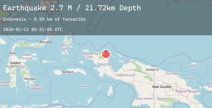
Earthquake West Papua Region, Indonesia
Mon, 12 Jan 2026 05:51:09 GMT
Time7 hours ago
Location
-0.7747, 133.8391
Depth
10.0 KM
Event Summary
A 2.7 magnitude earthquake struck on West Papua Region, Indonesia, at Mon, 12 Jan 2026 05:51:09 GMT. Depth: 10km. Reviewed by BMKG seismologists, this minor quake occurred at a magnitude type of M.
Magnitude
2.7
M
Source
BMKG
Intensity
-
Agency Reports
1 Sources| Source | Magnitude | Depth | Time |
|---|---|---|---|
| BMKGPrimary | 2.7 | 10 km | 7 hours ago |
Earthquake Details
AutomaticEvent IDbmg2026auod
Tsunami PotentialNo
Magnitude TypeM
Nearest Places
- Kampung Yonggam0.2 km
- Kampung Warbefor2.5 km
- Kampung Singgimeba2.7 km
- Sungai Musuakaing2.8 km
- Sungai Prati3.3 km
Comments
Join the discussion about this event.
Latest Earthquakes
4.0Mag
Northern Sumatra, Indonesia
Time7 hours ago
Depth169.97 km
SourceBMKG (Automatic)
2.5Mag
Java, Indonesia
Time7 hours ago
Depth20.77 km
SourceBMKG (Automatic)
4.2Mag
Talaud Islands, Indonesia
Time7 hours ago
Depth33.75 km
SourceBMKG (Automatic)
1.6Mag
WESTERN TURKEY
Time7 hours ago
Depth7.10 km
SourceAFAD (Automatic)
1.9Mag
45 km WNW of Cantwell, Alaska
Time7 hours ago
Depth104.00 km
SourceUSGS (Automatic)
Nearby Earthquakes
No significant earthquakes nearby recently.