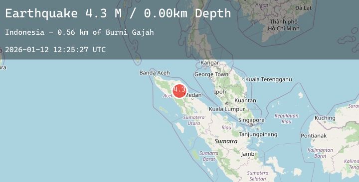
Earthquake Northern Sumatra, Indonesia
Mon, 12 Jan 2026 12:25:31 GMT
Time13 hours ago
Location
4.1144, 97.4642
Depth
10.0 KM
Event Summary
A 4.1 magnitude earthquake struck on Northern Sumatra, Indonesia, at Mon, 12 Jan 2026 12:25:31 GMT. Depth: 10km. Reviewed by BMKG seismologists, this light quake occurred at a magnitude type of M.
Magnitude
4.1
M
Source
BMKG
Intensity
-
Agency Reports
1 Sources| Source | Magnitude | Depth | Time |
|---|---|---|---|
| BMKGPrimary | 4.1 | 10 km | 13 hours ago |
Earthquake Details
AutomaticEvent IDbmg2026avbd
Tsunami PotentialNo
Magnitude TypeM
Nearest Places
- Waih Gajah3.5 km
- Gampong Gajah3.9 km
- Aer Putih5.2 km
- Oreng5.5 km
- Waih Uring6.1 km
Comments
Join the discussion about this event.
Latest Earthquakes
2.6Mag
GREECE
Time13 hours ago
Depth12.60 km
SourceNOA (Automatic)
1.7Mag
60 km S of Whites City, New Mexico
Time13 hours ago
Depth4.21 km
SourceUSGS (Automatic)
1.4Mag
8 km ENE of Lake Arrowhead, CA
Time13 hours ago
Depth7.23 km
SourceUSGS (Automatic)
2.3Mag
16 km SSW of Nanwalek, Alaska
Time13 hours ago
Depth64.60 km
SourceUSGS (Automatic)
2.4Mag
Southern Sumatra, Indonesia
Time13 hours ago
Depth79.10 km
SourceBMKG (Automatic)