Earthquake Seram, Indonesia
Mon, 12 Jan 2026 17:43:22 GMT
Time5 hours ago
Location
-3.0316, 127.9188
Depth
23.9 KM
Event Summary
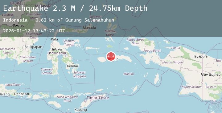
A 2.8 magnitude earthquake struck on Seram, Indonesia, at Mon, 12 Jan 2026 17:43:22 GMT. Depth: 23.855017km. Reviewed by BMKG seismologists, this minor quake occurred at a magnitude type of M.
Magnitude
2.8
M
Source
BMKG
Intensity
-
Agency Reports
1 Sources| Source | Magnitude | Depth | Time |
|---|---|---|---|
| BMKGPrimary | 2.8 | 24 km | 5 hours ago |
Earthquake Details
AutomaticEvent IDbmg2026avlp
Tsunami PotentialNo
Magnitude TypeM
Nearest Places
- Tanjung Henaputih0.8 km
- Wai Tenua1.1 km
- Labuan Sinohi1.4 km
- Wai Inamasai1.7 km
- Tanjung Labuhansinobi1.7 km
Comments
Join the discussion about this event.
Latest Earthquakes
1.1Mag
17 km SSW of Searles Valley, CA
Time5 hours ago
Depth9.37 km
SourceUSGS (Automatic)
4.4Mag
OFFSHORE OAXACA, MEXICO
Time5 hours ago
Depth16.40 km
SourceUNM (Automatic)
2.4Mag
Flores Region, Indonesia
Time5 hours ago
Depth146.15 km
SourceBMKG (Automatic)
2.5Mag
Sumbawa Region, Indonesia
Time5 hours ago
Depth38.07 km
SourceBMKG (Automatic)
3.9Mag
Seram, Indonesia
Time5 hours ago
Depth16.87 km
SourceBMKG (Automatic)