Earthquake Timor Region
Tue, 13 Jan 2026 01:16:11 GMT
Time2 hours ago
Location
-10.2183, 123.1558
Depth
29.3 KM
Event Summary
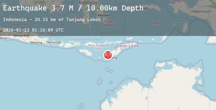
A 3.6 magnitude earthquake struck on Timor Region, at Tue, 13 Jan 2026 01:16:11 GMT. Depth: 29.255501km. Reviewed by BMKG seismologists, this minor quake occurred at a magnitude type of M.
Magnitude
3.6
M
Source
BMKG
Intensity
-
Agency Reports
1 Sources| Source | Magnitude | Depth | Time |
|---|---|---|---|
| BMKGPrimary | 3.6 | 29 km | 2 hours ago |
Earthquake Details
AutomaticEvent IDbmg2026awao
Tsunami PotentialNo
Magnitude TypeM
Nearest Places
- Pulau Tabui16.8 km
- Tanjung Lokon16.9 km
- Tanjung Onanlui17.1 km
- Tanjung Klobe17.4 km
- Teluk Lusing18.1 km
Comments
Join the discussion about this event.
Latest Earthquakes
0.7Mag
9 km NW of The Geysers, CA
Time2 hours ago
Depth2.20 km
SourceUSGS (Automatic)
2.2Mag
ISLAND OF HAWAII, HAWAII
Time2 hours ago
Depth2.90 km
SourceHV (Automatic)
1.9Mag
65 km ESE of Cantwell, Alaska
Time2 hours ago
Depth3.60 km
SourceUSGS (Automatic)
1.2Mag
EASTERN TURKEY
Time2 hours ago
Depth7.20 km
SourceAFAD (Automatic)
3.0Mag
Northern Sumatra, Indonesia
Time2 hours ago
Depth5.81 km
SourceBMKG (Automatic)