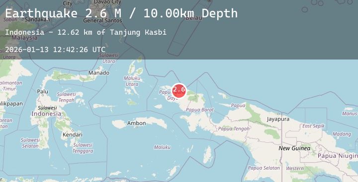
Earthquake West Papua Region, Indonesia
Tue, 13 Jan 2026 12:42:26 GMT
Time1 day ago
Location
-0.4968, 131.9159
Depth
10.0 KM
Event Summary
A 2.6 magnitude earthquake struck on West Papua Region, Indonesia, at Tue, 13 Jan 2026 12:42:26 GMT. Depth: 10km. Reviewed by BMKG seismologists, this minor quake occurred at a magnitude type of M.
Magnitude
2.6
M
Source
BMKG
Intensity
-
Agency Reports
1 Sources| Source | Magnitude | Depth | Time |
|---|---|---|---|
| BMKGPrimary | 2.6 | 10 km | 1 day ago |
Earthquake Details
AutomaticEvent IDbmg2026awxe
Tsunami PotentialNo
Magnitude TypeM
Nearest Places
- Tanjung Kasbi12.6 km
- Teluk Sansapor13.7 km
- Tanjung Sawasar16.3 km
- Kampung Warmanen16.7 km
- Kampung Warmasi16.9 km
Comments
Join the discussion about this event.
Latest Earthquakes
1.9Mag
31 km E of Pāhala, Hawaii
Time1 day ago
Depth0.69 km
SourceUSGS (Automatic)
2.5Mag
28 km S of Volcano, Hawaii
Time1 day ago
Depth40.57 km
SourceUSGS (Automatic)
2.3Mag
CENTRAL CALIFORNIA
Time1 day ago
Depth23.70 km
SourceNC (Automatic)
1.5Mag
SWITZERLAND
Time1 day ago
Depth3.70 km
SourceETHZ (Automatic)
2.5Mag
Sumbawa Region, Indonesia
Time1 day ago
Depth13.55 km
SourceBMKG (Automatic)