Earthquake Sumbawa Region, Indonesia
Wed, 21 Jan 2026 10:48:42 GMT
Time6 days ago
Location
-8.8709, 118.6593
Depth
10.5 KM
Event Summary
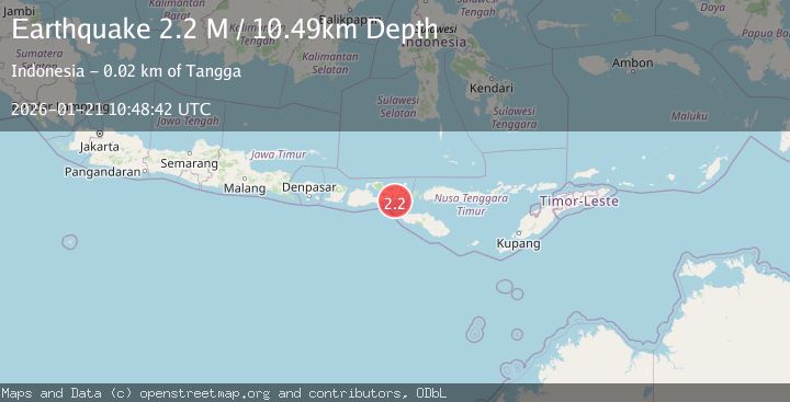
A 2.2 magnitude earthquake struck on Sumbawa Region, Indonesia, at Wed, 21 Jan 2026 10:48:42 GMT. Depth: 10.494881km. Reviewed by BMKG seismologists, this minor quake occurred at a magnitude type of M.
Magnitude
2.2
M
Source
BMKG
Intensity
-
Agency Reports
1 Sources| Source | Magnitude | Depth | Time |
|---|---|---|---|
| BMKGPrimary | 2.2 | 10 km | 6 days ago |
Earthquake Details
AutomaticEvent IDbmg2026bljm
Tsunami PotentialNo
Magnitude TypeM
Nearest Places
- Toro Panggae6.3 km
- Toro Karyawandali6.4 km
- Teluk Woro6.5 km
- Teluk Nggupadapa6.5 km
- Doro Keriandali6.6 km
Comments
Join the discussion about this event.
Latest Earthquakes
2.6Mag
Minahassa Peninsula, Sulawesi
Time18 hours ago
Depth118.00 km
SourceBMKG (Automatic)
2.8Mag
South of Bali, Indonesia
Time18 hours ago
Depth10.00 km
SourceBMKG (Automatic)
1.7Mag
31 km SE of Denali National Park, Alaska
Time18 hours ago
Depth0.60 km
SourceUSGS (Automatic)
2.2Mag
WESTERN TURKEY
Time18 hours ago
Depth14.90 km
SourceKOERI (Automatic)
2.2Mag
13 km NW of Ferry, Alaska
Time18 hours ago
Depth139.50 km
SourceUSGS (Automatic)
Nearby Earthquakes
2.4Mag
Sumbawa Region, Indonesia
Time3 days ago
Depth10.00 km
SourceBMKG (Automatic)
2.1Mag
Sumbawa Region, Indonesia
Time2 days ago
Depth26.23 km
SourceBMKG (Automatic)
2.2Mag
Sumbawa Region, Indonesia
Time4 days ago
Depth10.00 km
SourceBMKG (Automatic)
2.0Mag
Sumbawa Region, Indonesia
Time2 days ago
Depth110.77 km
SourceBMKG (Automatic)
2.4Mag
Sumbawa Region, Indonesia
Time5 days ago
Depth10.01 km
SourceBMKG (Automatic)