Earthquake Bali Sea
Sun, 25 Jan 2026 09:06:25 GMT
Time2 days ago
Location
-6.8358, 115.9119
Depth
10.2 KM
Event Summary
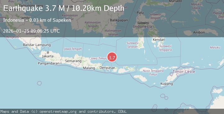
A 3.7 magnitude earthquake struck on Bali Sea, at Sun, 25 Jan 2026 09:06:25 GMT. Depth: 10.199km. Reviewed by BMKG seismologists, this minor quake occurred at a magnitude type of M.
Magnitude
3.7
M
Source
BMKG
Intensity
-
Agency Reports
1 Sources| Source | Magnitude | Depth | Time |
|---|---|---|---|
| BMKGPrimary | 3.7 | 10 km | 2 days ago |
Earthquake Details
AutomaticEvent IDbmg2026bsoc
Tsunami PotentialNo
Magnitude TypeM
Nearest Places
- Gosong Sedulang12.5 km
- Pulau Togo-togo12.7 km
- Mesigil12.8 km
- Tanjungpagar13.2 km
- Pulau Pagerungan Besar13.3 km
Comments
Join the discussion about this event.
Latest Earthquakes
1.2Mag
13 km WSW of Stanton, Texas
Time18 hours ago
Depth3.46 km
SourceUSGS (Automatic)
2.0Mag
WESTERN TURKEY
Time18 hours ago
Depth7.60 km
SourceKOERI (Automatic)
4.4Mag
Sulawesi, Indonesia
Time18 hours ago
Depth5.00 km
SourceBMKG (Automatic)
1.8Mag
PYRENEES
Time18 hours ago
Depth1.40 km
SourceIGN (Automatic)
2.6Mag
Minahassa Peninsula, Sulawesi
Time18 hours ago
Depth118.00 km
SourceBMKG (Automatic)
Nearby Earthquakes
2.7Mag
Bali Sea
Time2 days ago
Depth10.00 km
SourceBMKG (Automatic)
2.9Mag
Bali Sea
Time3 days ago
Depth15.74 km
SourceBMKG (Automatic)
2.6Mag
Sumbawa Region, Indonesia
Time1 day ago
Depth253.04 km
SourceBMKG (Automatic)
2.1Mag
Sumbawa Region, Indonesia
Time20 hours ago
Depth17.97 km
SourceBMKG (Automatic)
2.5Mag
Bali Sea
Time2 days ago
Depth14.54 km
SourceBMKG (Automatic)