Earthquake Flores Region, Indonesia
Mon, 26 Jan 2026 01:13:18 GMT
Time1 day ago
Location
-8.0577, 119.0150
Depth
35.6 KM
Event Summary
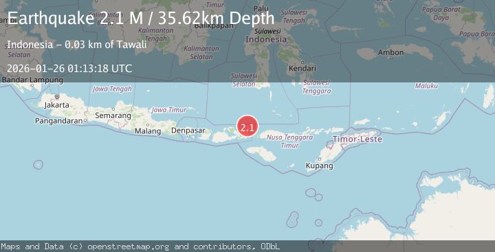
A 2.1 magnitude earthquake struck on Flores Region, Indonesia, at Mon, 26 Jan 2026 01:13:18 GMT. Depth: 35.617054km. Reviewed by BMKG seismologists, this minor quake occurred at a magnitude type of M.
Magnitude
2.1
M
Source
BMKG
Intensity
-
Agency Reports
1 Sources| Source | Magnitude | Depth | Time |
|---|---|---|---|
| BMKGPrimary | 2.1 | 36 km | 1 day ago |
Earthquake Details
AutomaticEvent IDbmg2026bttz
Tsunami PotentialNo
Magnitude TypeM
Nearest Places
- Desa Sangiang16.1 km
- Pulau Sangeang16.1 km
- Gunung Api16.5 km
- Gunungapi17.7 km
- Selat Sangeang23.3 km
Comments
Join the discussion about this event.
Latest Earthquakes
1.6Mag
4 km SE of Julian, CA
Time16 minutes ago
Depth10.57 km
SourceUSGS (Automatic)
3.4Mag
BIO-BIO, CHILE
Time19 minutes ago
Depth17.50 km
SourceCSN (Automatic)
2.7Mag
FRANCE
Time24 minutes ago
Depth5.00 km
SourceReNaSS (Automatic)
3.0Mag
South of Bali, Indonesia
Time25 minutes ago
Depth21.74 km
SourceBMKG (Automatic)
3.6Mag
EASTERN TURKEY
Time34 minutes ago
Depth0.00 km
SourceKOERI (Automatic)
Nearby Earthquakes
2.5Mag
Flores Sea
Time4 days ago
Depth25.83 km
SourceBMKG (Automatic)
2.3Mag
Flores Sea
Time5 days ago
Depth29.87 km
SourceBMKG (Automatic)
2.6Mag
Sumbawa Region, Indonesia
Time15 hours ago
Depth153.32 km
SourceBMKG (Automatic)
2.9Mag
Flores Region, Indonesia
Time4 days ago
Depth16.32 km
SourceBMKG (Automatic)
2.2Mag
Flores Region, Indonesia
Time1 day ago
Depth10.00 km
SourceBMKG (Automatic)