Earthquake Minahassa Peninsula, Sulawesi
Thu, 29 Jan 2026 14:14:59 GMT
Time1 hour ago
Location
0.9023, 119.8548
Depth
41.7 KM
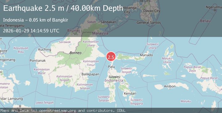
Event Summary
A 2.4 magnitude earthquake struck on Minahassa Peninsula, Sulawesi, at Thu, 29 Jan 2026 14:14:59 GMT. Depth: 41.659859km. Reviewed by BMKG seismologists, this minor quake occurred at a magnitude type of M.
Magnitude
2.4
M
Source
BMKG
Intensity
-
Agency Reports
1 Sources| Source | Magnitude | Depth | Time |
|---|---|---|---|
| BMKGPrimary | 2.4 | 42 km | 1 hour ago |
Earthquake Details
AutomaticEvent IDbmg2026cagi
Tsunami PotentialNo
Magnitude TypeM
Nearest Places
- Pulau Soyangi28.9 km
- Tando Sojol29.0 km
- Pulau Pesi29.9 km
- Pulau Manukmanuk30.0 km
- Tando Baingan30.1 km
Comments
Join the discussion about this event.
Latest Earthquakes
1.1Mag
5 km W of Cobb, CA
Time1 hour ago
Depth1.84 km
SourceUSGS (Automatic)
2.3Mag
Sumbawa Region, Indonesia
Time1 hour ago
Depth24.84 km
SourceBMKG (Automatic)
1.6Mag
7 km NNE of Coso Junction, CA
Time1 hour ago
Depth3.84 km
SourceUSGS (Automatic)
1.8Mag
22 km SSE of Eureka Roadhouse, Alaska
Time1 hour ago
Depth35.50 km
SourceUSGS (Automatic)
1.6Mag
WESTERN TURKEY
Time1 hour ago
Depth15.40 km
SourceEMSC (Automatic)
Nearby Earthquakes
2.4Mag
Minahassa Peninsula, Sulawesi
Time1 week ago
Depth21.76 km
SourceBMKG (Automatic)
2.5Mag
Minahassa Peninsula, Sulawesi
Time22 hours ago
Depth5.00 km
SourceBMKG (Automatic)
2.6Mag
Minahassa Peninsula, Sulawesi
Time6 days ago
Depth52.69 km
SourceBMKG (Automatic)
2.5Mag
Minahassa Peninsula, Sulawesi
Time1 day ago
Depth47.66 km
SourceBMKG (Automatic)
2.4Mag
Minahassa Peninsula, Sulawesi
Time4 days ago
Depth3.37 km
SourceBMKG (Automatic)