Earthquake North of Halmahera, Indonesia
Fri, 30 Jan 2026 11:36:26 GMT
Time1 hour ago
Location
3.0100, 128.1223
Depth
5.5 KM
Event Summary
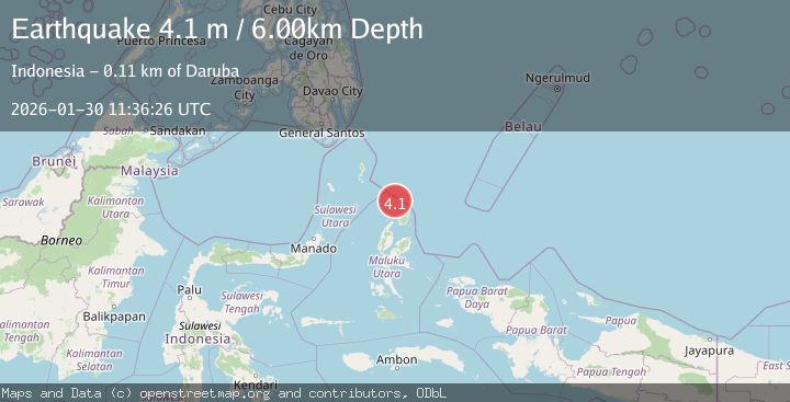
A 4.1 magnitude earthquake struck on North of Halmahera, Indonesia, at Fri, 30 Jan 2026 11:36:26 GMT. Depth: 5.504243km. Reviewed by BMKG seismologists, this light quake occurred at a magnitude type of M.
Magnitude
4.1
M
Source
BMKG
Intensity
-
Agency Reports
1 Sources| Source | Magnitude | Depth | Time |
|---|---|---|---|
| BMKGPrimary | 4.1 | 6 km | 1 hour ago |
Earthquake Details
AutomaticEvent IDbmg2026cbwo
Tsunami PotentialNo
Magnitude TypeM
Nearest Places
- Morotai Basin13.6 km
- Tanjung Berri Berri59.7 km
- Tanjung Padangi59.9 km
- Bere Bere61.0 km
- Padangi61.3 km
Comments
Join the discussion about this event.
Latest Earthquakes
2.7Mag
Java, Indonesia
Time1 hour ago
Depth15.61 km
SourceBMKG (Automatic)
2.3Mag
WESTERN TURKEY
Time1 hour ago
Depth8.60 km
SourceKOERI (Automatic)
1.3Mag
2 km NW of Garden City, Texas
Time1 hour ago
Depth0.82 km
SourceUSGS (Automatic)
2.6Mag
Java, Indonesia
Time1 hour ago
Depth10.00 km
SourceBMKG (Automatic)
3.3Mag
MYANMAR
Time1 hour ago
Depth10.00 km
SourceTSB (Automatic)
Nearby Earthquakes
3.1Mag
HALMAHERA, INDONESIA
Time6 days ago
Depth186.00 km
SourceBMKG (Automatic)
3.4Mag
Halmahera, Indonesia
Time1 week ago
Depth197.00 km
SourceBMKG (Automatic)
3.5Mag
Halmahera, Indonesia
Time1 week ago
Depth209.55 km
SourceBMKG (Automatic)
3.5Mag
Talaud Islands, Indonesia
Time1 week ago
Depth18.12 km
SourceBMKG (Automatic)
2.5Mag
Halmahera, Indonesia
Time2 days ago
Depth132.87 km
SourceBMKG (Automatic)