Earthquake West Papua Region, Indonesia
Mon, 02 Feb 2026 08:02:56 GMT
Time10 hours ago
Location
-0.4348, 130.2005
Depth
12.1 KM
Event Summary
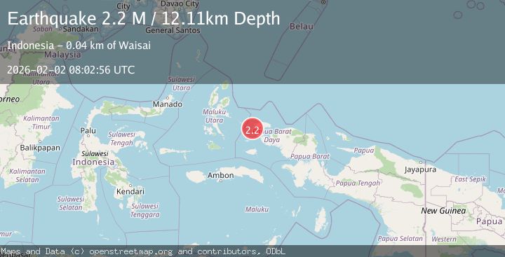
A 2.2 magnitude earthquake struck on West Papua Region, Indonesia, at Mon, 02 Feb 2026 08:02:56 GMT. Depth: 12.106598km. Reviewed by BMKG seismologists, this minor quake occurred at a magnitude type of M.
Magnitude
2.2
M
Source
BMKG
Intensity
-
Agency Reports
1 Sources| Source | Magnitude | Depth | Time |
|---|---|---|---|
| BMKGPrimary | 2.2 | 12 km | 10 hours ago |
Earthquake Details
AutomaticEvent IDbmg2026chca
Tsunami PotentialNo
Magnitude TypeM
Nearest Places
- Pulau Fwoyo4.7 km
- Pulau Yefm9.0 km
- Pulau Miosmengkara9.1 km
- Pulau Miosarar9.2 km
- Kampung Meosmanggara9.2 km
Comments
Join the discussion about this event.
Latest Earthquakes
1.4Mag
NORTHERN ITALY
Time10 hours ago
Depth6.00 km
SourceOGS (Automatic)
4.4Mag
Sulawesi, Indonesia
Time10 hours ago
Depth5.00 km
SourceBMKG (Automatic)
3.3Mag
Sulawesi, Indonesia
Time10 hours ago
Depth5.00 km
SourceBMKG (Automatic)
3.5Mag
43 km SE of Denali National Park, Alaska
Time11 hours ago
Depth6.70 km
SourceUSGS (Automatic)
2.8Mag
ANTOFAGASTA, CHILE
Time11 hours ago
Depth127.80 km
SourceCSN (Automatic)
Nearby Earthquakes
2.8Mag
Halmahera, Indonesia
Time1 week ago
Depth20.95 km
SourceBMKG (Automatic)
2.7Mag
Halmahera, Indonesia
Time2 days ago
Depth10.00 km
SourceBMKG (Automatic)
2.5Mag
West Papua Region, Indonesia
Time5 days ago
Depth15.32 km
SourceBMKG (Automatic)
2.2Mag
Halmahera, Indonesia
Time1 week ago
Depth12.67 km
SourceBMKG (Automatic)
3.2Mag
Halmahera, Indonesia
Time1 week ago
Depth10.00 km
SourceBMKG (Automatic)