Earthquake Southern Sumatra, Indonesia
Tue, 03 Feb 2026 08:53:30 GMT
Time2 weeks ago
Location
-5.8589, 104.0622
Depth
18.6 KM
Event Summary
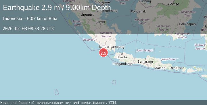
A 2.9 magnitude earthquake struck on Southern Sumatra, Indonesia, at Tue, 03 Feb 2026 08:53:30 GMT. Depth: 18.602524km. Reviewed by BMKG seismologists, this minor quake occurred at a magnitude type of M.
Magnitude
2.9
M
Source
BMKG
Intensity
-
Agency Reports
1 Sources| Source | Magnitude | Depth | Time |
|---|---|---|---|
| BMKGPrimary | 2.9 | 9 km | 2 weeks ago |
Earthquake Details
AutomaticEvent IDbmg2026cizf
Tsunami PotentialNo
Magnitude TypeM
Nearest Places
- Cukuh Batuberagam36.8 km
- Teluk Bengkunat37.6 km
- Enggano Basin37.9 km
- Wai Heni38.0 km
- Wai Cukung38.1 km
Comments
Join the discussion about this event.
Latest Earthquakes
1.1Mag
Washington
Time5 minutes ago
Depth9.64 km
SourceVYT (Automatic)
1.9Mag
32 km NW of Toyah, Texas
Time8 minutes ago
Depth4.09 km
SourceUSGS (Automatic)
1.7Mag
western Texas
Time11 minutes ago
Depth3.42 km
SourceVYT (Automatic)
3.8Mag
Seram, Indonesia
Time13 minutes ago
Depth0.00 km
SourceVYT (Automatic)
1.6Mag
54 km WNW of Toyah, Texas
Time18 minutes ago
Depth0.00 km
SourceUSGS (Automatic)
Nearby Earthquakes
3.0Mag
SOUTHERN SUMATRA, INDONESIA
Time10 months ago
Depth10.00 km
SourceBMKG (Automatic)
3.0Mag
SOUTHERN SUMATRA, INDONESIA
Time2 years ago
Depth10.00 km
SourceBMKG (Automatic)
5.5Mag
SOUTHERN SUMATRA, INDONESIA
Time20 years ago
Depth2.00 km
SourceEMSC (Automatic)
5.6Mag
SOUTHERN SUMATRA, INDONESIA
Time10 years ago
Depth76.00 km
SourceEMSC (Automatic)
3.0Mag
SOUTHERN SUMATRA, INDONESIA
Time3 months ago
Depth25.00 km
SourceBMKG (Automatic)