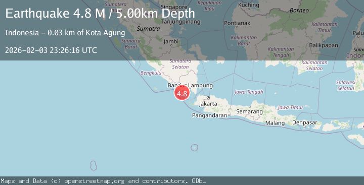
Earthquake Southern Sumatra, Indonesia
Tue, 03 Feb 2026 23:26:14 GMT
Time15 hours ago
Location
-5.7515, 104.5225
Depth
6.7 KM
Event Summary
A 4.5 magnitude earthquake struck on Southern Sumatra, Indonesia, at Tue, 03 Feb 2026 23:26:14 GMT. Depth: 6.693344km. Reviewed by BMKG seismologists, this light quake occurred at a magnitude type of M.
Magnitude
4.5
M
Source
BMKG
Intensity
-
Agency Reports
1 Sources| Source | Magnitude | Depth | Time |
|---|---|---|---|
| BMKGPrimary | 4.5 | 7 km | 15 hours ago |
Earthquake Details
AutomaticEvent IDbmg2026ckbz
Tsunami PotentialNo
Magnitude TypeM
Nearest Places
- Wai Lunik2.5 km
- Kubulugor3.0 km
- Kubusaruk3.0 km
- Pematang Pembambanan3.7 km
- Kubuhibu3.8 km
Comments
Join the discussion about this event.
Latest Earthquakes
1.6Mag
11 km NNW of Nellis Air Force Base, Nevada
Time15 hours ago
Depth3.77 km
SourceUSGS (Automatic)
2.9Mag
OKLAHOMA
Time15 hours ago
Depth6.80 km
SourceOK (Automatic)
2.1Mag
HAWAII REGION, HAWAII
Time16 hours ago
Depth5.80 km
SourceHV (Automatic)
3.3Mag
Banda Sea
Time16 hours ago
Depth222.94 km
SourceBMKG (Automatic)
1.7Mag
10 km WNW of Lake Elsinore, CA
Time16 hours ago
Depth10.88 km
SourceUSGS (Automatic)
Nearby Earthquakes
2.5Mag
Southern Sumatra, Indonesia
Time1 week ago
Depth10.48 km
SourceBMKG (Automatic)
2.5Mag
Southern Sumatra, Indonesia
Time6 days ago
Depth15.67 km
SourceBMKG (Automatic)
2.3Mag
Southern Sumatra, Indonesia
Time1 week ago
Depth71.47 km
SourceBMKG (Automatic)
2.7Mag
Southern Sumatra, Indonesia
Time1 week ago
Depth10.00 km
SourceBMKG (Automatic)
2.7Mag
Sunda Strait, Indonesia
Time1 week ago
Depth26.51 km
SourceBMKG (Automatic)