Earthquake Seram, Indonesia
Fri, 06 Feb 2026 22:55:24 GMT
Time1 hour ago
Location
-2.7559, 129.5028
Depth
34.2 KM
Event Summary
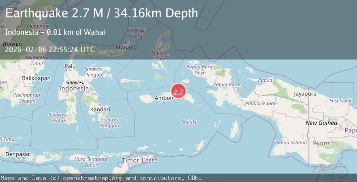
A 2.7 magnitude earthquake struck on Seram, Indonesia, at Fri, 06 Feb 2026 22:55:24 GMT. Depth: 34.158672km. Reviewed by BMKG seismologists, this minor quake occurred at a magnitude type of M.
Magnitude
2.7
M
Source
BMKG
Intensity
-
Agency Reports
1 Sources| Source | Magnitude | Depth | Time |
|---|---|---|---|
| BMKGPrimary | 2.7 | 34 km | 1 hour ago |
Earthquake Details
AutomaticEvent IDbmg2026cpnm
Tsunami PotentialNo
Magnitude TypeM
Nearest Places
- Teluk Haliling3.7 km
- Tanjung Hewal3.9 km
- Teluk Wahai3.9 km
- Hatuwe4.4 km
- Wae Wahai4.9 km
Comments
Join the discussion about this event.
Latest Earthquakes
3.3Mag
MOROCCO
Time9 minutes ago
Depth10.00 km
SourceIGN (Automatic)
2.6Mag
47 km NW of San Antonio, Puerto Rico
Time24 minutes ago
Depth21.25 km
SourceUSGS
2.7Mag
OFF COAST OF COSTA RICA
Time28 minutes ago
Depth14.00 km
SourceUNA (Automatic)
1.5Mag
TURKEY-SYRIA BORDER REGION
Time31 minutes ago
Depth7.00 km
SourceEMSC (Automatic)
3.0Mag
STRAIT OF GIBRALTAR
Time35 minutes ago
Depth13.40 km
SourceIGN (Automatic)
Nearby Earthquakes
3.4Mag
Seram, Indonesia
Time5 days ago
Depth10.00 km
SourceBMKG (Automatic)
2.8Mag
Seram, Indonesia
Time1 week ago
Depth10.00 km
SourceBMKG (Automatic)
2.8Mag
Seram, Indonesia
Time1 week ago
Depth10.00 km
SourceBMKG (Automatic)
2.3Mag
Seram, Indonesia
Time1 day ago
Depth10.00 km
SourceBMKG (Automatic)
2.6Mag
Seram, Indonesia
Time1 week ago
Depth2.62 km
SourceBMKG (Automatic)