Earthquake Celebes Sea
Mon, 09 Feb 2026 00:38:19 GMT
Time1 month ago
Location
2.1649, 122.3553
Depth
7.0 KM
Event Summary
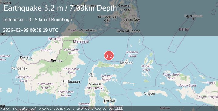
A 3.2 magnitude earthquake struck on Celebes Sea, at Mon, 09 Feb 2026 00:38:19 GMT. Depth: 7km. Reviewed by BMKG seismologists, this minor quake occurred at a magnitude type of M.
Magnitude
3.2
M
Source
BMKG
Intensity
-
Agency Reports
1 Sources| Source | Magnitude | Depth | Time |
|---|---|---|---|
| BMKGPrimary | 3.2 | 7 km | 1 month ago |
Earthquake Details
AutomaticEvent IDbmg2026cthw
QualityS
Tsunami PotentialNo
Magnitude TypeM
Last Update1 month ago
Felt Reports0
Did you feel this earthquake? Report it to help others.
No reports yet
Be the first to report this earthquake!
Latest Earthquakes
Loading...
Nearby Earthquakes
5.2Mag
Minahasa, Sulawesi, Indonesia
Time6 days ago
Depth540.77 km
SourceVYT (Automatic)
5.3Mag
Minahassa Peninsula, Sulawesi
Time6 days ago
Depth546.81 km
SourceBMKG
2.6Mag
MINAHASA, SULAWESI, INDONESIA
Time3 weeks ago
Depth18.00 km
SourceBMKG (Automatic)
3.2Mag
Celebes Sea
Time3 weeks ago
Depth10.00 km
SourceBMKG
4.2Mag
Celebes Sea
Time1 month ago
Depth601.07 km
SourceVYT (Automatic)