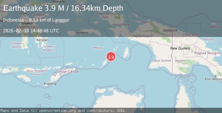
Earthquake Tanimbar Islands Region, Indonesia
Tue, 10 Feb 2026 14:40:48 GMT
Time1 month ago
Location
-6.7159, 132.2881
Depth
16.3 KM
Event Summary
A 3.9 magnitude earthquake struck on Tanimbar Islands Region, Indonesia, at Tue, 10 Feb 2026 14:40:48 GMT. Depth: 16.342344km. Reviewed by BMKG seismologists, this minor quake occurred at a magnitude type of M.
Magnitude
3.9
M
Source
BMKG
Intensity
-
Agency Reports
1 Sources| Source | Magnitude | Depth | Time |
|---|---|---|---|
| BMKGPrimary | 3.9 | 16 km | 1 month ago |
Earthquake Details
ManualEvent IDbmg2026cwfe
QualityS
Tsunami PotentialNo
Magnitude TypeM
Last Update1 month ago
Felt Reports0
Did you feel this earthquake? Report it to help others.
No reports yet
Be the first to report this earthquake!
Latest Earthquakes
Loading...
Nearby Earthquakes
3.7Mag
Kepulauan Tanimbar, Indonesia
Time1 day ago
Depth722.29 km
SourceVYT (Automatic)
4.4Mag
Kepulauan Tanimbar, Indonesia
Time4 days ago
Depth154.42 km
SourceVYT (Automatic)
3.3Mag
Kepulauan Tanimbar, Indonesia
Time4 days ago
Depth658.94 km
SourceVYT (Automatic)
3.5Mag
Tanimbar Islands Region, Indonesia
Time5 days ago
Depth132.26 km
SourceBMKG
3.8Mag
Kepulauan Tanimbar, Indonesia
Time1 week ago
Depth0.00 km
SourceVYT (Automatic)