Earthquake West Papua, Indonesia
Tue, 10 Feb 2026 19:16:10 GMT
Time1 week ago
Location
-2.8935, 138.3610
Depth
10.0 KM
Event Summary
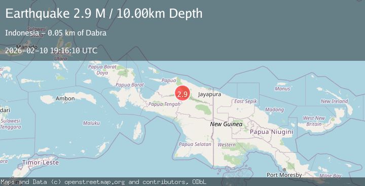
A 2.9 magnitude earthquake struck on West Papua, Indonesia, at Tue, 10 Feb 2026 19:16:10 GMT. Depth: 10km. Reviewed by BMKG seismologists, this minor quake occurred at a magnitude type of M.
Magnitude
2.9
M
Source
BMKG
Intensity
-
Agency Reports
1 Sources| Source | Magnitude | Depth | Time |
|---|---|---|---|
| BMKGPrimary | 2.9 | 10 km | 1 week ago |
Earthquake Details
ManualEvent IDbmg2026cwog
Tsunami PotentialNo
Magnitude TypeM
Nearest Places
- Tariku7.3 km
- Meervlakte7.4 km
- Sungai Tariku7.5 km
- Pulau Kalong9.2 km
- Kampung Prawa10.7 km
Comments
Join the discussion about this event.
Latest Earthquakes
1.7Mag
Central Alaska
Time4 minutes ago
Depth86.30 km
SourceVYT (Automatic)
4.6Mag
Tarapaca, Chile
Time7 minutes ago
Depth111.45 km
SourceVYT (Automatic)
2.4Mag
Tarapaca, Chile
Time20 minutes ago
Depth0.00 km
SourceVYT (Automatic)
0.8Mag
4 km NW of The Geysers, CA
Time23 minutes ago
Depth3.24 km
SourceUSGS (Automatic)
1.8Mag
Tarapaca, Chile
Time24 minutes ago
Depth0.00 km
SourceVYT (Automatic)
Nearby Earthquakes
5.0Mag
PAPUA, INDONESIA
Time6 years ago
Depth60.00 km
SourceEMSC (Automatic)
5.3Mag
PAPUA, INDONESIA
Time9 years ago
Depth30.00 km
SourceEMSC (Automatic)
5.4Mag
PAPUA, INDONESIA
Time6 years ago
Depth10.00 km
SourceEMSC (Automatic)
5.7Mag
PAPUA, INDONESIA
Time6 years ago
Depth10.00 km
SourceEMSC (Automatic)
4.0Mag
PAPUA, INDONESIA
Time6 years ago
Depth10.00 km
SourceDJA (Automatic)