Earthquake Southern Sumatra, Indonesia
Wed, 11 Feb 2026 11:11:57 GMT
Time1 week ago
Location
-0.2212, 100.4955
Depth
3.6 KM
Event Summary
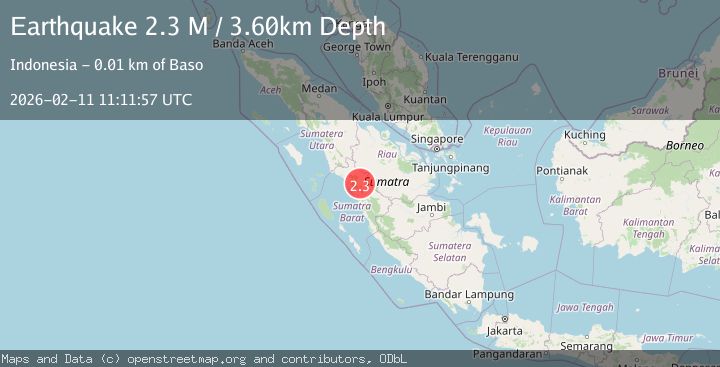
A 2.3 magnitude earthquake struck on Southern Sumatra, Indonesia, at Wed, 11 Feb 2026 11:11:57 GMT. Depth: 3.595914km. Reviewed by BMKG seismologists, this minor quake occurred at a magnitude type of M.
Magnitude
2.3
M
Source
BMKG
Intensity
-
Agency Reports
1 Sources| Source | Magnitude | Depth | Time |
|---|---|---|---|
| BMKGPrimary | 2.3 | 4 km | 1 week ago |
Earthquake Details
ManualEvent IDbmg2026cxtu
Tsunami PotentialNo
Magnitude TypeM
Nearest Places
- Kotabaru1.7 km
- Nagari Sungai Balantiak1.7 km
- Kecamatan Akabiluru2.7 km
- Gunung Kapanasan2.9 km
- Bukit Solok3.0 km
Comments
Join the discussion about this event.
Latest Earthquakes
1.3Mag
Southern Alaska
Time2 minutes ago
Depth0.00 km
SourceVYT (Automatic)
1.2Mag
Central Alaska
Time8 minutes ago
Depth32.71 km
SourceVYT (Automatic)
2.4Mag
DODECANESE IS.-TURKEY BORDER REG
Time10 minutes ago
Depth8.10 km
SourceKOERI (Automatic)
1.5Mag
western Texas
Time12 minutes ago
Depth0.24 km
SourceVYT (Automatic)
1.8Mag
western Texas
Time14 minutes ago
Depth9.77 km
SourceVYT (Automatic)
Nearby Earthquakes
2.5Mag
SOUTHERN SUMATRA, INDONESIA
Time1 month ago
Depth6.00 km
SourceBMKG (Automatic)
2.6Mag
SOUTHERN SUMATRA, INDONESIA
Time1 month ago
Depth10.00 km
SourceBMKG (Automatic)
2.5Mag
SOUTHERN SUMATRA, INDONESIA
Time0 months ago
Depth10.00 km
SourceBMKG (Automatic)
3.0Mag
SOUTHERN SUMATRA, INDONESIA
Time1 year ago
Depth5.00 km
SourceBMKG (Automatic)
3.0Mag
SOUTHERN SUMATRA, INDONESIA
Time1 year ago
Depth10.00 km
SourceBMKG (Automatic)