Earthquake West Papua, Indonesia
Fri, 13 Feb 2026 05:06:43 GMT
Time5 days ago
Location
-3.1130, 139.7317
Depth
10.0 KM
Event Summary
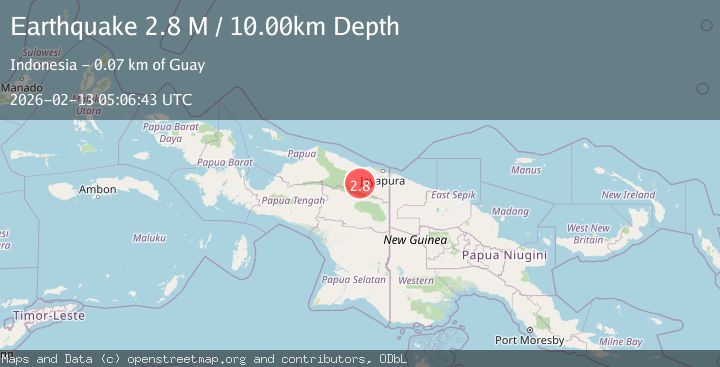
A 2.8 magnitude earthquake struck on West Papua, Indonesia, at Fri, 13 Feb 2026 05:06:43 GMT. Depth: 10km. Reviewed by BMKG seismologists, this minor quake occurred at a magnitude type of M.
Magnitude
2.8
M
Source
BMKG
Intensity
-
Agency Reports
1 Sources| Source | Magnitude | Depth | Time |
|---|---|---|---|
| BMKGPrimary | 2.8 | 10 km | 5 days ago |
Earthquake Details
ManualEvent IDbmg2026dayt
Tsunami PotentialNo
Magnitude TypeM
Nearest Places
- Kampung Umbron7.9 km
- Abo15.8 km
- Distrik Kaureh16.1 km
- Barito18.2 km
- Lereh18.8 km
Comments
Join the discussion about this event.
Latest Earthquakes
1.9Mag
western Texas
Time6 minutes ago
Depth0.24 km
SourceVYT (Automatic)
2.2Mag
western Texas
Time9 minutes ago
Depth0.24 km
SourceVYT (Automatic)
2.2Mag
Valparaiso, Chile
Time10 minutes ago
Depth22.83 km
SourceVYT (Automatic)
4.5Mag
Central Alaska
Time11 minutes ago
Depth7.81 km
SourceVYT (Automatic)
1.9Mag
1 km SSW of Pāhala, Hawaii
Time15 minutes ago
Depth28.47 km
SourceUSGS (Automatic)
Nearby Earthquakes
5.0Mag
PAPUA, INDONESIA
Time7 years ago
Depth68.00 km
SourceEMSC (Automatic)
5.5Mag
PAPUA, INDONESIA
Time16 years ago
Depth52.00 km
SourceEMSC (Automatic)
5.1Mag
PAPUA, INDONESIA
Time3 years ago
Depth80.00 km
SourceEMSC (Automatic)
2.5Mag
PAPUA, INDONESIA
Time1 month ago
Depth20.00 km
SourceBMKG (Automatic)
3.0Mag
PAPUA, INDONESIA
Time3 years ago
Depth19.00 km
SourceDJA (Automatic)