Earthquake Northern Molucca Sea
Fri, 13 Feb 2026 06:48:34 GMT
Time6 days ago
Location
2.2076, 126.2609
Depth
0.0 KM
Event Summary
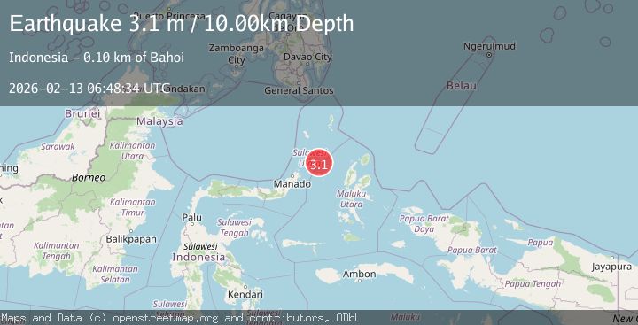
A 3.1 magnitude earthquake struck on Northern Molucca Sea, at Fri, 13 Feb 2026 06:48:34 GMT. Depth: 0km. Reviewed by BMKG seismologists, this minor quake occurred at a magnitude type of M.
Magnitude
3.1
M
Source
BMKG
Intensity
-
Agency Reports
1 Sources| Source | Magnitude | Depth | Time |
|---|---|---|---|
| BMKGPrimary | 3.1 | 10 km | 6 days ago |
Earthquake Details
ManualEvent IDbmg2026dbcc
Tsunami PotentialNo
Magnitude TypeM
Nearest Places
- Tonggeng Manandu89.7 km
- Tonggeng Tuwoliang89.9 km
- Teluk Buha89.9 km
- Saluhi Sikola90.2 km
- Teluk Palumpungan90.2 km
Comments
Join the discussion about this event.
Latest Earthquakes
1.9Mag
Finland
Time6 minutes ago
Depth1.22 km
SourceVYT (Automatic)
1.3Mag
Southern Alaska
Time6 minutes ago
Depth16.36 km
SourceVYT (Automatic)
0.7Mag
7 km W of Cobb, CA
Time6 minutes ago
Depth2.05 km
SourceUSGS (Automatic)
2.2Mag
Tarapaca, Chile
Time10 minutes ago
Depth16.97 km
SourceVYT (Automatic)
1.8Mag
24 km ESE of Naalehu, Hawaii
Time12 minutes ago
Depth31.03 km
SourceUSGS (Automatic)
Nearby Earthquakes
3.5Mag
MOLUCCA SEA
Time1 month ago
Depth13.00 km
SourceBMKG (Automatic)
4.0Mag
MOLUCCA SEA
Time1 year ago
Depth25.00 km
SourceBMKG (Automatic)
5.5Mag
MOLUCCA SEA
Time13 years ago
Depth60.00 km
SourceEMSC (Automatic)
3.0Mag
MOLUCCA SEA
Time3 months ago
Depth10.00 km
SourceBMKG (Automatic)
3.0Mag
MOLUCCA SEA
Time1 month ago
Depth103.00 km
SourceBMKG (Automatic)