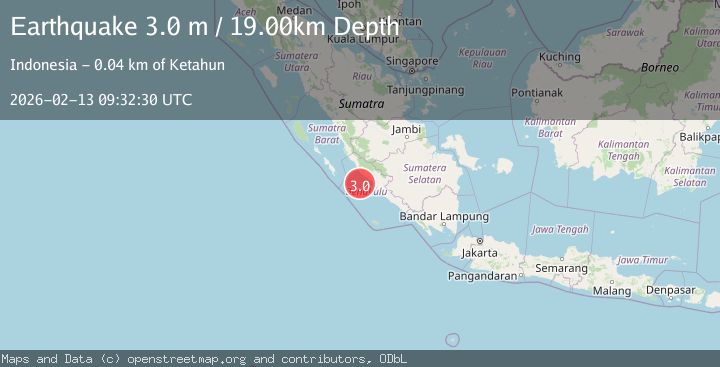
Earthquake Southern Sumatra, Indonesia
Fri, 13 Feb 2026 09:32:30 GMT
Time6 days ago
Location
-3.6506, 101.6018
Depth
19.3 KM
Event Summary
A 3.0 magnitude earthquake struck on Southern Sumatra, Indonesia, at Fri, 13 Feb 2026 09:32:30 GMT. Depth: 19.340418km. Reviewed by BMKG seismologists, this minor quake occurred at a magnitude type of M.
Magnitude
3.0
M
Source
BMKG
Intensity
-
Agency Reports
1 Sources| Source | Magnitude | Depth | Time |
|---|---|---|---|
| BMKGPrimary | 3.0 | 19 km | 6 days ago |
Earthquake Details
ManualEvent IDbmg2026dbhn
Tsunami PotentialNo
Magnitude TypeM
Nearest Places
- Sungai Ketahun38.0 km
- Ketahun38.9 km
- Desa Pasar Ketahun38.9 km
- Sungai Urai39.2 km
- Desa Lubuk Mindai39.5 km
Comments
Join the discussion about this event.
Latest Earthquakes
2.2Mag
Sulawesi, Indonesia
Time8 minutes ago
Depth17.09 km
SourceBMKG
3.2Mag
Southeastern Alaska
Time11 minutes ago
Depth0.00 km
SourceVYT (Automatic)
0.8Mag
6 km WNW of Cobb, CA
Time13 minutes ago
Depth1.91 km
SourceUSGS (Automatic)
2.9Mag
STRAIT OF GIBRALTAR
Time14 minutes ago
Depth5.00 km
SourceIGN (Automatic)
0.9Mag
7 km NW of The Geysers, CA
Time17 minutes ago
Depth2.49 km
SourceUSGS (Automatic)
Nearby Earthquakes
2.6Mag
Southern Sumatra, Indonesia
Time3 weeks ago
Depth25.66 km
SourceBMKG (Automatic)
3.0Mag
SOUTHERN SUMATRA, INDONESIA
Time4 years ago
Depth28.00 km
SourceDJA (Automatic)
3.0Mag
SOUTHERN SUMATRA, INDONESIA
Time2 years ago
Depth29.00 km
SourceDJA (Automatic)
3.0Mag
SOUTHERN SUMATRA, INDONESIA
Time4 months ago
Depth28.00 km
SourceBMKG (Automatic)
3.0Mag
SOUTHERN SUMATRA, INDONESIA
Time4 years ago
Depth11.00 km
SourceDJA (Automatic)