Earthquake Southern Sumatra, Indonesia
Fri, 13 Feb 2026 21:23:54 GMT
Time4 days ago
Location
-5.3010, 104.5848
Depth
10.1 KM
Event Summary
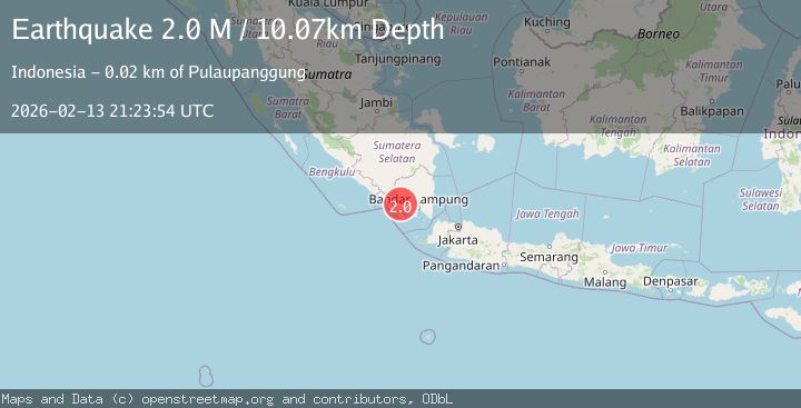
A 2.0 magnitude earthquake struck on Southern Sumatra, Indonesia, at Fri, 13 Feb 2026 21:23:54 GMT. Depth: 10.070879km. Reviewed by BMKG seismologists, this minor quake occurred at a magnitude type of M.
Magnitude
2.0
M
Source
BMKG
Intensity
-
Agency Reports
1 Sources| Source | Magnitude | Depth | Time |
|---|---|---|---|
| BMKGPrimary | 2.0 | 10 km | 4 days ago |
Earthquake Details
ManualEvent IDbmg2026dcez
Tsunami PotentialNo
Magnitude TypeM
Nearest Places
- Airlingkar0.4 km
- Desa Muara Dua Ulu Belu1.3 km
- Talangsuganda1.6 km
- Talangmarsum1.7 km
- Talangtomo1.8 km
Comments
Join the discussion about this event.
Latest Earthquakes
1.1Mag
6 km NW of The Geysers, CA
Time10 hours ago
Depth1.72 km
SourceUSGS (Automatic)
1.8Mag
Central Alaska
Time10 hours ago
Depth0.00 km
SourceVYT (Automatic)
2.8Mag
WESTERN TURKEY
Time10 hours ago
Depth7.00 km
SourceAFAD (Automatic)
1.7Mag
Southern Alaska
Time10 hours ago
Depth31.01 km
SourceVYT (Automatic)
2.1Mag
HAWAII REGION, HAWAII
Time11 hours ago
Depth38.20 km
SourceHV (Automatic)
Nearby Earthquakes
3.0Mag
SOUTHERN SUMATRA, INDONESIA
Time1 month ago
Depth13.00 km
SourceBMKG (Automatic)
2.5Mag
SOUTHERN SUMATRA, INDONESIA
Time1 month ago
Depth6.00 km
SourceBMKG (Automatic)
2.0Mag
Southern Sumatra, Indonesia
Time2 weeks ago
Depth10.00 km
SourceBMKG (Automatic)
2.3Mag
Southern Sumatra, Indonesia
Time2 weeks ago
Depth15.95 km
SourceBMKG (Automatic)
2.5Mag
Southern Sumatra, Indonesia
Time4 days ago
Depth5.96 km
SourceBMKG