Earthquake Northern Sumatra, Indonesia
Fri, 13 Feb 2026 22:28:24 GMT
Time5 days ago
Location
1.0166, 98.7248
Depth
36.9 KM
Event Summary
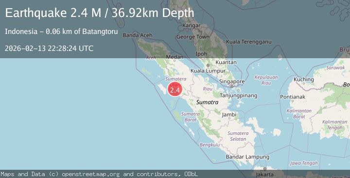
A 2.4 magnitude earthquake struck on Northern Sumatra, Indonesia, at Fri, 13 Feb 2026 22:28:24 GMT. Depth: 36.918228km. Reviewed by BMKG seismologists, this minor quake occurred at a magnitude type of M.
Magnitude
2.4
M
Source
BMKG
Intensity
-
Agency Reports
1 Sources| Source | Magnitude | Depth | Time |
|---|---|---|---|
| BMKGPrimary | 2.4 | 37 km | 5 days ago |
Earthquake Details
ManualEvent IDbmg2026dchc
Tsunami PotentialNo
Magnitude TypeM
Nearest Places
- Muara Singkuang22.8 km
- Aek Sikapas22.9 km
- Aek Batanggadis23.0 km
- Aek Siriam23.1 km
- Singkuang23.3 km
Comments
Join the discussion about this event.
Latest Earthquakes
3.3Mag
West Papua, Indonesia
Time8 minutes ago
Depth10.00 km
SourceBMKG
2.4Mag
Sumbawa Region, Indonesia
Time9 minutes ago
Depth24.94 km
SourceBMKG
2.2Mag
Tarapaca, Chile
Time17 minutes ago
Depth53.71 km
SourceVYT (Automatic)
3.9Mag
Mindanao, Philippines
Time18 minutes ago
Depth10.00 km
SourceBMKG
1.2Mag
WESTERN TURKEY
Time18 minutes ago
Depth7.00 km
SourceAFAD (Automatic)
Nearby Earthquakes
5.1Mag
NORTHERN SUMATRA, INDONESIA
Time14 years ago
Depth79.00 km
SourceEMSC (Automatic)
5.1Mag
NIAS REGION, INDONESIA
Time7 years ago
Depth80.00 km
SourceEMSC (Automatic)
5.2Mag
NIAS REGION, INDONESIA
Time7 years ago
Depth80.00 km
SourceEMSC (Automatic)
2.6Mag
NORTHERN SUMATRA, INDONESIA
Time1 month ago
Depth52.00 km
SourceBMKG (Automatic)
3.0Mag
NORTHERN SUMATRA, INDONESIA
Time1 year ago
Depth41.00 km
SourceBMKG (Automatic)