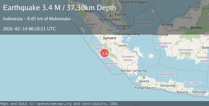
Earthquake Southern Sumatra, Indonesia
Sat, 14 Feb 2026 00:28:21 GMT
Time6 days ago
Location
-2.4569, 100.8875
Depth
37.3 KM
Event Summary
A 3.4 magnitude earthquake struck on Southern Sumatra, Indonesia, at Sat, 14 Feb 2026 00:28:21 GMT. Depth: 37.303436km. Reviewed by BMKG seismologists, this minor quake occurred at a magnitude type of M.
Magnitude
3.4
M
Source
BMKG
Intensity
-
Agency Reports
1 Sources| Source | Magnitude | Depth | Time |
|---|---|---|---|
| BMKGPrimary | 3.4 | 37 km | 6 days ago |
Earthquake Details
ManualEvent IDbmg2026dclb
Tsunami PotentialNo
Magnitude TypeM
Nearest Places
- Batang Air Silaut12.0 km
- Muaraterusanbunga12.6 km
- Pasarlalang12.9 km
- Nagari Air Hitam14.5 km
- Nagari Silaut14.8 km
Comments
Join the discussion about this event.
Latest Earthquakes
2.3Mag
Sulawesi, Indonesia
Time6 minutes ago
Depth1.90 km
SourceBMKG
1.8Mag
western Texas
Time7 minutes ago
Depth0.12 km
SourceVYT (Automatic)
3.8Mag
Banda Sea
Time9 minutes ago
Depth66.28 km
SourceBMKG
3.9Mag
Ceram Sea, Indonesia
Time9 minutes ago
Depth160.52 km
SourceVYT (Automatic)
3.6Mag
Banda Sea
Time12 minutes ago
Depth146.21 km
SourceBMKG
Nearby Earthquakes
6.0Mag
SOUTHERN SUMATRA, INDONESIA
Time18 years ago
Depth30.00 km
SourceEMSC (Automatic)
3.0Mag
KEP. MENTAWAI REGION, INDONESIA
Time0 years ago
Depth36.00 km
SourceBMKG (Automatic)
5.6Mag
SOUTHERN SUMATRA, INDONESIA
Time18 years ago
Depth30.00 km
SourceEMSC (Automatic)
3.0Mag
KEP. MENTAWAI REGION, INDONESIA
Time2 years ago
Depth39.00 km
SourceDJA (Automatic)
3.6Mag
KEP. MENTAWAI REGION, INDONESIA
Time1 month ago
Depth26.00 km
SourceBMKG (Automatic)