Earthquake Northern Sumatra, Indonesia
Sat, 14 Feb 2026 10:29:19 GMT
Time5 days ago
Location
0.3993, 98.0251
Depth
3.6 KM
Event Summary
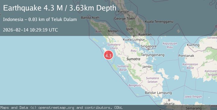
A 4.3 magnitude earthquake struck on Northern Sumatra, Indonesia, at Sat, 14 Feb 2026 10:29:19 GMT. Depth: 3.634613km. Reviewed by BMKG seismologists, this light quake occurred at a magnitude type of M.
Magnitude
4.3
M
Source
BMKG
Intensity
-
Agency Reports
1 Sources| Source | Magnitude | Depth | Time |
|---|---|---|---|
| BMKGPrimary | 4.3 | 4 km | 5 days ago |
Earthquake Details
ManualEvent IDbmg2026ddex
Tsunami PotentialNo
Magnitude TypeM
Nearest Places
- Great Channel16.8 km
- Tanjung Hele27.5 km
- Tanjung Batu27.8 km
- Teluk Dalam27.8 km
- Hiliganowo28.1 km
Comments
Join the discussion about this event.
Latest Earthquakes
2.1Mag
Tarapaca, Chile
Time2 minutes ago
Depth0.00 km
SourceVYT (Automatic)
2.1Mag
near the coast of Tarapaca, Chile
Time4 minutes ago
Depth24.41 km
SourceVYT (Automatic)
2.8Mag
Northern Sumatra, Indonesia
Time16 minutes ago
Depth5.00 km
SourceBMKG
2.0Mag
Tarapaca, Chile
Time17 minutes ago
Depth0.00 km
SourceVYT (Automatic)
2.7Mag
MENDOZA, ARGENTINA
Time22 minutes ago
Depth115.00 km
SourceNSNA (Automatic)
Nearby Earthquakes
3.0Mag
NIAS REGION, INDONESIA
Time4 years ago
Depth10.00 km
SourceDJA (Automatic)
5.4Mag
NIAS REGION, INDONESIA
Time19 years ago
Depth30.00 km
SourceEMSC (Automatic)
5.4Mag
NIAS REGION, INDONESIA
Time20 years ago
Depth20.00 km
SourceEMSC (Automatic)
5.0Mag
NIAS REGION, INDONESIA
Time9 years ago
Depth10.00 km
SourceEMSC (Automatic)
3.5Mag
NIAS REGION, INDONESIA
Time1 month ago
Depth5.00 km
SourceBMKG (Automatic)