Earthquake Sumbawa Region, Indonesia
Sat, 14 Feb 2026 19:22:16 GMT
Time5 days ago
Location
-9.2920, 117.4040
Depth
52.9 KM
Event Summary
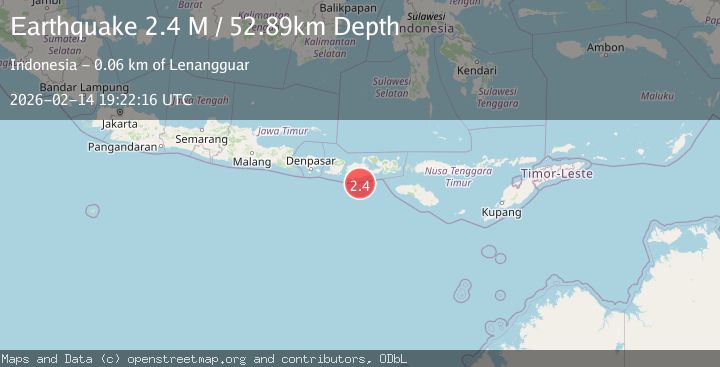
A 2.4 magnitude earthquake struck on Sumbawa Region, Indonesia, at Sat, 14 Feb 2026 19:22:16 GMT. Depth: 52.887806km. Reviewed by BMKG seismologists, this minor quake occurred at a magnitude type of M.
Magnitude
2.4
M
Source
BMKG
Intensity
-
Agency Reports
1 Sources| Source | Magnitude | Depth | Time |
|---|---|---|---|
| BMKGPrimary | 2.4 | 53 km | 5 days ago |
Earthquake Details
ManualEvent IDbmg2026ddwm
Tsunami PotentialNo
Magnitude TypeM
Nearest Places
- Tanjung Liongsong25.3 km
- Teluk Sarang27.2 km
- Tanjung Sebu28.0 km
- Teluk Lampit28.6 km
- Sungai Dodo28.9 km
Comments
Join the discussion about this event.
Latest Earthquakes
3.4Mag
Ceram Sea, Indonesia
Time1 minute ago
Depth0.00 km
SourceVYT (Automatic)
2.0Mag
Unimak Island region, Alaska
Time1 minute ago
Depth32.10 km
SourceVYT (Automatic)
2.3Mag
Central Alaska
Time4 minutes ago
Depth0.00 km
SourceVYT (Automatic)
2.8Mag
Valparaiso, Chile
Time8 minutes ago
Depth20.02 km
SourceVYT (Automatic)
1.3Mag
Tarapaca, Chile
Time11 minutes ago
Depth0.00 km
SourceVYT (Automatic)
Nearby Earthquakes
5.5Mag
SUMBAWA REGION, INDONESIA
Time20 years ago
Depth10.00 km
SourceEMSC (Automatic)
3.0Mag
SUMBAWA REGION, INDONESIA
Time9 months ago
Depth64.00 km
SourceBMKG (Automatic)
4.0Mag
SUMBAWA REGION, INDONESIA
Time1 year ago
Depth25.00 km
SourceBMKG (Automatic)
2.2Mag
Sumbawa Region, Indonesia
Time1 week ago
Depth26.39 km
SourceBMKG
3.0Mag
SUMBAWA REGION, INDONESIA
Time8 months ago
Depth42.00 km
SourceBMKG (Automatic)