Earthquake Timor Region
Mon, 16 Feb 2026 06:16:51 GMT
Time6 days ago
Location
-8.7328, 124.1481
Depth
85.9 KM
Event Summary
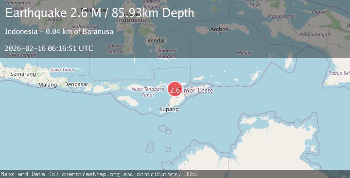
A 2.6 magnitude earthquake struck on Timor Region, at Mon, 16 Feb 2026 06:16:51 GMT. Depth: 85.931335km. Reviewed by BMKG seismologists, this minor quake occurred at a magnitude type of M.
Magnitude
2.6
M
Source
BMKG
Intensity
-
Agency Reports
1 Sources| Source | Magnitude | Depth | Time |
|---|---|---|---|
| BMKGPrimary | 2.6 | 86 km | 6 days ago |
Earthquake Details
ManualEvent IDbmg2026dgno
Tsunami PotentialNo
Magnitude TypeM
Nearest Places
- 21.7 km
- 22.1 km
- 22.3 km
- 23.0 km
- 23.3 km
Comments
Join the discussion about this event.
Latest Earthquakes
1.3Mag
Southern Alaska
Time5 hours ago
Depth13.06 km
SourceVYT (Automatic)
1.3Mag
WESTERN TURKEY
Time5 hours ago
Depth7.00 km
SourceAFAD (Automatic)
2.7Mag
Fox Islands, Aleutian Islands, Alaska
Time5 hours ago
Depth0.00 km
SourceVYT (Automatic)
5.1Mag
Coquimbo, Chile
Time5 hours ago
Depth0.00 km
SourceVYT (Automatic)
2.0Mag
HAWAII REGION, HAWAII
Time5 hours ago
Depth3.00 km
SourceHV (Automatic)
Nearby Earthquakes
3.0Mag
KEPULAUAN ALOR, INDONESIA
Time5 years ago
Depth32.00 km
SourceDJA (Automatic)
3.0Mag
KEPULAUAN ALOR, INDONESIA
Time4 years ago
Depth83.00 km
SourceDJA (Automatic)
2.5Mag
KEPULAUAN ALOR, INDONESIA
Time1 month ago
Depth86.00 km
SourceBMKG (Automatic)
3.0Mag
KEPULAUAN ALOR, INDONESIA
Time1 year ago
Depth64.00 km
SourceBMKG (Automatic)
4.0Mag
KEPULAUAN ALOR, INDONESIA
Time10 months ago
Depth42.00 km
SourceBMKG (Automatic)