Earthquake West Papua, Indonesia
Mon, 16 Feb 2026 20:06:33 GMT
Time3 days ago
Location
-5.9616, 139.6226
Depth
10.0 KM
Event Summary
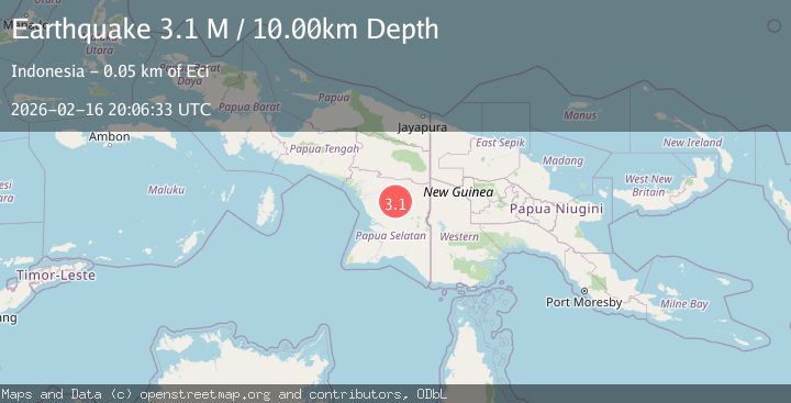
A 3.1 magnitude earthquake struck on West Papua, Indonesia, at Mon, 16 Feb 2026 20:06:33 GMT. Depth: 10km. Reviewed by BMKG seismologists, this minor quake occurred at a magnitude type of M.
Magnitude
3.1
M
Source
BMKG
Intensity
-
Agency Reports
1 Sources| Source | Magnitude | Depth | Time |
|---|---|---|---|
| BMKGPrimary | 3.1 | 10 km | 3 days ago |
Earthquake Details
ManualEvent IDbmg2026dhoz
Tsunami PotentialNo
Magnitude TypeM
Nearest Places
- Kampung Veta8.1 km
- Kampung Haku10.8 km
- Distrik Passue Bawah11.1 km
- Kampung Honya12.4 km
- Kampung Keta13.0 km
Comments
Join the discussion about this event.
Latest Earthquakes
4.5Mag
Tarapaca, Chile
Time2 minutes ago
Depth128.42 km
SourceVYT (Automatic)
1.5Mag
4 km NE of Muscoy, CA
Time9 minutes ago
Depth7.69 km
SourceUSGS (Automatic)
0.8Mag
6 km W of Cobb, CA
Time10 minutes ago
Depth0.90 km
SourceUSGS (Automatic)
1.4Mag
Southern Alaska
Time14 minutes ago
Depth70.19 km
SourceVYT (Automatic)
1.3Mag
14 km SW of Toms Place, CA
Time15 minutes ago
Depth5.49 km
SourceUSGS (Automatic)
Nearby Earthquakes
5.1Mag
PAPUA, INDONESIA
Time14 years ago
Depth30.00 km
SourceEMSC (Automatic)
5.5Mag
NEAR S COAST OF PAPUA, INDONESIA
Time10 months ago
Depth35.00 km
SourceEMSC (Automatic)
5.4Mag
PAPUA, INDONESIA
Time5 years ago
Depth10.00 km
SourceEMSC (Automatic)
5.8Mag
PAPUA, INDONESIA
Time14 years ago
Depth2.00 km
SourceEMSC (Automatic)
5.5Mag
PAPUA, INDONESIA
Time16 years ago
Depth40.00 km
SourceEMSC (Automatic)