Earthquake Flores Region, Indonesia
Tue, 17 Feb 2026 01:32:24 GMT
Time1 day ago
Location
-8.5722, 123.5798
Depth
88.8 KM
Event Summary
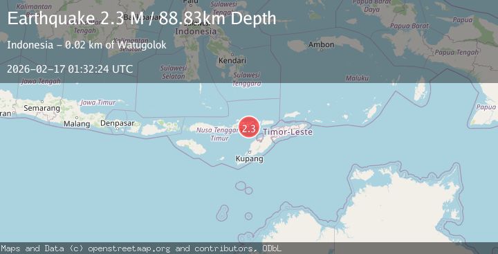
A 2.3 magnitude earthquake struck on Flores Region, Indonesia, at Tue, 17 Feb 2026 01:32:24 GMT. Depth: 88.830917km. Reviewed by BMKG seismologists, this minor quake occurred at a magnitude type of M.
Magnitude
2.3
M
Source
BMKG
Intensity
-
Agency Reports
1 Sources| Source | Magnitude | Depth | Time |
|---|---|---|---|
| BMKGPrimary | 2.3 | 89 km | 1 day ago |
Earthquake Details
ManualEvent IDbmg2026dhzs
Tsunami PotentialNo
Magnitude TypeM
Nearest Places
- Teluk Waibura2.5 km
- Tanjung Penutun2.5 km
- Tanjung Wakoilar2.5 km
- Wai Bura2.6 km
- Wai Werun2.7 km
Comments
Join the discussion about this event.
Latest Earthquakes
2.8Mag
Sulawesi, Indonesia
Time1 minute ago
Depth21.08 km
SourceBMKG
2.1Mag
WESTERN TURKEY
Time5 minutes ago
Depth12.30 km
SourceKOERI (Automatic)
2.2Mag
Alaska Peninsula
Time5 minutes ago
Depth57.74 km
SourceVYT (Automatic)
3.7Mag
WESTERN TURKEY
Time8 minutes ago
Depth13.30 km
SourceKOERI (Automatic)
1.6Mag
27 km ESE of Balmorhea, Texas
Time8 minutes ago
Depth3.56 km
SourceUSGS (Automatic)
Nearby Earthquakes
5.5Mag
FLORES REGION, INDONESIA
Time16 years ago
Depth182.00 km
SourceEMSC (Automatic)
3.0Mag
FLORES REGION, INDONESIA
Time4 years ago
Depth45.00 km
SourceDJA (Automatic)
2.5Mag
Flores Region, Indonesia
Time1 week ago
Depth16.94 km
SourceBMKG (Automatic)
2.5Mag
Flores Region, Indonesia
Time12 hours ago
Depth119.99 km
SourceBMKG
3.0Mag
FLORES REGION, INDONESIA
Time4 years ago
Depth35.00 km
SourceDJA (Automatic)