Earthquake Minahassa Peninsula, Sulawesi
Thu, 19 Feb 2026 03:35:19 GMT
Time5 hours ago
Location
1.4920, 122.1332
Depth
11.2 KM
Event Summary
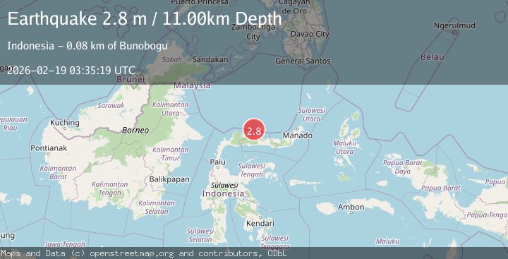
A 2.8 magnitude earthquake struck on Minahassa Peninsula, Sulawesi, at Thu, 19 Feb 2026 03:35:19 GMT. Depth: 11.178504km. Reviewed by BMKG seismologists, this minor quake occurred at a magnitude type of M.
Magnitude
2.8
M
Source
BMKG
Intensity
-
Agency Reports
1 Sources| Source | Magnitude | Depth | Time |
|---|---|---|---|
| BMKGPrimary | 2.8 | 11 km | 5 hours ago |
Earthquake Details
ManualEvent IDbmg2026dlut
Tsunami PotentialNo
Magnitude TypeM
Nearest Places
- Karang Ponilungan44.6 km
- Karang Lobu45.1 km
- Karang Bulilanga45.6 km
- Batu Lumajagu47.0 km
- Tunggilio Kapi47.3 km
Comments
Join the discussion about this event.
Latest Earthquakes
1.8Mag
Central Alaska
Time5 hours ago
Depth18.43 km
SourceVYT (Automatic)
1.5Mag
Central California
Time5 hours ago
Depth0.00 km
SourceVYT (Automatic)
0.7Mag
Washington
Time5 hours ago
Depth0.00 km
SourceVYT (Automatic)
2.8Mag
Antofagasta, Chile
Time5 hours ago
Depth102.66 km
SourceVYT (Automatic)
2.5Mag
British Columbia, Canada
Time5 hours ago
Depth0.00 km
SourceVYT (Automatic)
Nearby Earthquakes
3.0Mag
MINAHASA, SULAWESI, INDONESIA
Time10 months ago
Depth10.00 km
SourceBMKG (Automatic)
5.7Mag
Minahasa, Sulawesi, Indonesia
Time9 hours ago
Depth31.98 km
SourceVYT (Automatic)
7.4Mag
MINAHASA, SULAWESI, INDONESIA
Time17 years ago
Depth20.00 km
SourceEMSC (Automatic)
5.6Mag
MINAHASA, SULAWESI, INDONESIA
Time13 years ago
Depth30.00 km
SourceEMSC (Automatic)
3.3Mag
Minahasa, Sulawesi, Indonesia
Time4 days ago
Depth0.00 km
SourceVYT (Automatic)