Earthquake Minahassa Peninsula, Sulawesi
Thu, 19 Feb 2026 11:12:08 GMT
Time2 hours ago
Location
-0.1158, 123.2136
Depth
135.9 KM
Event Summary
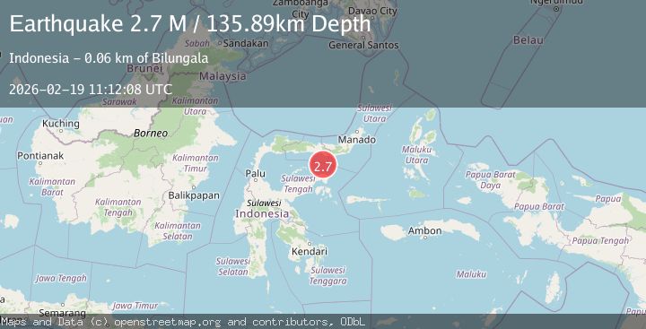
A 2.7 magnitude earthquake struck on Minahassa Peninsula, Sulawesi, at Thu, 19 Feb 2026 11:12:08 GMT. Depth: 135.890747km. Reviewed by BMKG seismologists, this minor quake occurred at a magnitude type of M.
Magnitude
2.7
M
Source
BMKG
Intensity
-
Agency Reports
1 Sources| Source | Magnitude | Depth | Time |
|---|---|---|---|
| BMKGPrimary | 2.7 | 136 km | 2 hours ago |
Earthquake Details
ManualEvent IDbmg2026dmjv
Tsunami PotentialNo
Magnitude TypeM
Nearest Places
- Pulau Mantawalu Daka46.2 km
- Tombalilatu48.6 km
- Wulungiyo Mamungaa48.8 km
- Wulungiyo Bangahu48.9 km
- Wulungiyo Olobu49.0 km
Comments
Join the discussion about this event.
Latest Earthquakes
2.1Mag
Slovakia
Time2 hours ago
Depth0.00 km
SourceVYT (Automatic)
2.4Mag
FRANCE
Time2 hours ago
Depth5.00 km
SourceReNaSS (Automatic)
2.9Mag
Southeastern Alaska
Time2 hours ago
Depth0.00 km
SourceVYT (Automatic)
1.8Mag
66 km ESE of Naalehu, Hawaii
Time2 hours ago
Depth12.54 km
SourceUSGS (Automatic)
2.1Mag
northern Alaska
Time2 hours ago
Depth0.00 km
SourceVYT (Automatic)
Nearby Earthquakes
3.0Mag
SULAWESI, INDONESIA
Time6 months ago
Depth127.00 km
SourceBMKG (Automatic)
4.0Mag
SULAWESI, INDONESIA
Time5 years ago
Depth140.00 km
SourceDJA (Automatic)
3.0Mag
SULAWESI, INDONESIA
Time2 years ago
Depth157.00 km
SourceBMKG (Automatic)
3.0Mag
SULAWESI, INDONESIA
Time2 years ago
Depth128.00 km
SourceBMKG (Automatic)
2.7Mag
SULAWESI, INDONESIA
Time1 month ago
Depth127.00 km
SourceBMKG (Automatic)