Earthquake Sumba Region, Indonesia
Thu, 19 Feb 2026 13:54:00 GMT
Time1 hour ago
Location
-9.0390, 119.6290
Depth
17.7 KM
Event Summary
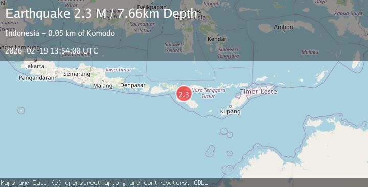
A 2.2 magnitude earthquake struck on Sumba Region, Indonesia, at Thu, 19 Feb 2026 13:54:00 GMT. Depth: 17.71236km. Reviewed by BMKG seismologists, this minor quake occurred at a magnitude type of M.
Magnitude
2.2
M
Source
BMKG
Intensity
-
Agency Reports
1 Sources| Source | Magnitude | Depth | Time |
|---|---|---|---|
| BMKGPrimary | 2.2 | 18 km | 1 hour ago |
Earthquake Details
ManualEvent IDbmg2026dmpe
Tsunami PotentialNo
Magnitude TypeM
Nearest Places
- Toro Baturuncing24.8 km
- Toro Batumandi25.2 km
- Pulau Batuputih25.5 km
- Toro Kode25.8 km
- Toro Lemo26.0 km
Comments
Join the discussion about this event.
Latest Earthquakes
3.6Mag
Southern Alaska
Time1 hour ago
Depth10.74 km
SourceVYT (Automatic)
4.0Mag
OFF COAST OF NORTHERN PERU
Time1 hour ago
Depth48.00 km
SourceLIM (Automatic)
3.2Mag
NEAR EAST COAST OF HONSHU, JAPAN
Time1 hour ago
Depth30.00 km
SourceJMA (Automatic)
3.9Mag
Mindanao, Philippines
Time1 hour ago
Depth92.77 km
SourceVYT
3.7Mag
Mindanao, Philippines
Time1 hour ago
Depth116.58 km
SourceVYT (Automatic)
Nearby Earthquakes
3.0Mag
SUMBA REGION, INDONESIA
Time3 months ago
Depth10.00 km
SourceBMKG (Automatic)
3.1Mag
SUMBA REGION, INDONESIA
Time1 month ago
Depth9.00 km
SourceBMKG (Automatic)
3.0Mag
SUMBA REGION, INDONESIA
Time2 months ago
Depth10.00 km
SourceBMKG (Automatic)
2.1Mag
Sumba Region, Indonesia
Time1 week ago
Depth1.35 km
SourceBMKG (Automatic)
2.6Mag
SUMBA REGION, INDONESIA
Time1 month ago
Depth6.00 km
SourceBMKG (Automatic)