Earthquake Timor Region
Thu, 19 Feb 2026 18:44:18 GMT
Time1 hour ago
Location
-8.6578, 124.8732
Depth
14.4 KM
Event Summary
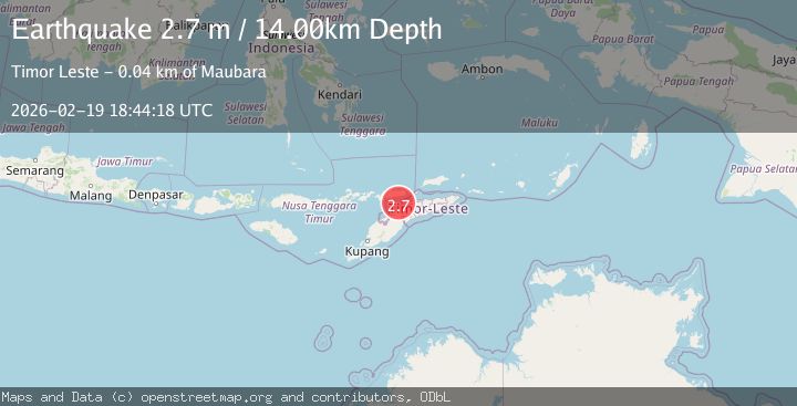
A 2.7 magnitude earthquake struck on Timor Region, at Thu, 19 Feb 2026 18:44:18 GMT. Depth: 14.443025km. Reviewed by BMKG seismologists, this minor quake occurred at a magnitude type of M.
Magnitude
2.7
M
Source
BMKG
Intensity
-
Agency Reports
1 Sources| Source | Magnitude | Depth | Time |
|---|---|---|---|
| BMKGPrimary | 2.7 | 14 km | 1 hour ago |
Earthquake Details
ManualEvent IDbmg2026dmyt
Tsunami PotentialNo
Magnitude TypeM
Nearest Places
- Tanjung Batuboroilo24.9 km
- Be Takabalan25.4 km
- Mota Watupulua25.5 km
- Mota Loes25.5 km
- Muara Loes25.5 km
Comments
Join the discussion about this event.
Latest Earthquakes
1.8Mag
Southeastern Alaska
Time57 minutes ago
Depth0.49 km
SourceVYT (Automatic)
1.8Mag
British Columbia, Canada
Time58 minutes ago
Depth0.00 km
SourceVYT (Automatic)
2.0Mag
SAN FRANCISCO BAY AREA, CALIF.
Time58 minutes ago
Depth18.40 km
SourceNC (Automatic)
2.2Mag
Sumbawa Region, Indonesia
Time59 minutes ago
Depth176.31 km
SourceBMKG
1.5Mag
Tarapaca, Chile
Time1 hour ago
Depth22.83 km
SourceVYT (Automatic)
Nearby Earthquakes
2.7Mag
KEPULAUAN ALOR, INDONESIA
Time1 month ago
Depth7.00 km
SourceBMKG (Automatic)
3.0Mag
KEPULAUAN ALOR, INDONESIA
Time4 months ago
Depth10.00 km
SourceBMKG (Automatic)
2.4Mag
Timor Region
Time3 weeks ago
Depth36.82 km
SourceBMKG (Automatic)
3.0Mag
KEPULAUAN ALOR, INDONESIA
Time2 months ago
Depth10.00 km
SourceBMKG (Automatic)
2.8Mag
KEPULAUAN ALOR, INDONESIA
Time1 month ago
Depth204.00 km
SourceBMKG (Automatic)