Earthquake West Papua, Indonesia
Thu, 19 Feb 2026 21:57:34 GMT
Time1 hour ago
Location
-3.1154, 139.3678
Depth
10.0 KM
Event Summary
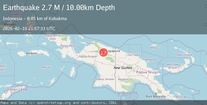
A 2.6 magnitude earthquake struck on West Papua, Indonesia, at Thu, 19 Feb 2026 21:57:34 GMT. Depth: 10km. Reviewed by BMKG seismologists, this minor quake occurred at a magnitude type of M.
Magnitude
2.6
M
Source
BMKG
Intensity
-
Agency Reports
1 Sources| Source | Magnitude | Depth | Time |
|---|---|---|---|
| BMKGPrimary | 2.6 | 10 km | 1 hour ago |
Earthquake Details
ManualEvent IDbmg2026dnfc
Tsunami PotentialNo
Magnitude TypeM
Nearest Places
- Kampung Ansudu Dua13.5 km
- Kampung Krim Podena19.0 km
- Kampung Kiren23.3 km
- Kampung Sunum24.1 km
- Kampung Tetom26.0 km
Comments
Join the discussion about this event.
Latest Earthquakes
1.4Mag
Southern Alaska
Time1 hour ago
Depth0.00 km
SourceVYT (Automatic)
1.7Mag
Unimak Island region, Alaska
Time1 hour ago
Depth0.00 km
SourceVYT (Automatic)
1.1Mag
British Columbia, Canada
Time1 hour ago
Depth6.35 km
SourceVYT (Automatic)
0.9Mag
5 km W of Cobb, CA
Time1 hour ago
Depth11.30 km
SourceUSGS (Automatic)
3.2Mag
Java, Indonesia
Time1 hour ago
Depth8.67 km
SourceVYT (Automatic)
Nearby Earthquakes
3.6Mag
PAPUA, INDONESIA
Time1 month ago
Depth14.00 km
SourceBMKG (Automatic)
5.1Mag
PAPUA, INDONESIA
Time18 years ago
Depth80.00 km
SourceEMSC (Automatic)
6.3Mag
PAPUA, INDONESIA
Time2 years ago
Depth32.80 km
SourceEMSC (Automatic)
3.9Mag
PAPUA, INDONESIA
Time1 month ago
Depth63.00 km
SourceBMKG (Automatic)
3.2Mag
NEAR N COAST OF PAPUA, INDONESIA
Time1 month ago
Depth55.00 km
SourceBMKG (Automatic)